  • English
  • Español
  • Français

United
Nations


Office for Outer Space Affairs
UN-SPIDER Knowledge Portal

  • Accueil
  • À propos
    • Qu'est-ce que l'ONU-SPIDER?
    • À propos d’UNOOSA
    • Publications
    • Offres d'emploi
    • Rencontrez l'équipe
    • Contact
  • Applications spatiales
    • Technologie satellitaire
    • Mécanismes d’urgence
    • Recovery Mechanisms
    • Réseau international d'alerte aux astéroïdes
    • Space Mission Planning Advisory Group
    • Initiative internationale sur la météorologie spatiale
    • Les technologies spatiales à l'ONU
    • Comptes-rendus d'utilisateurs
  • Liens & ressources
    • Application de données du mois
      • Disaster Recovery
    • Sources de données
    • SIG et logiciels de télédétection
    • Online Learning Resources
    • Institutions
  • Risques & catastrophes
    • Prévention des risques de catastrophe
    • Systèmes d'alerte précoce
    • Gestion des catastrophes et des interventions d'urgence
    • Aléas naturels
    • Cadre d'action de Sendai
    • L'ONU et la prévention des risques de catastrophe
    • L'ONU et les alertes précoces
    • L'ONU et la gestion des catastrophes
  • Appui technique
    • Missions Conseil
    • Appui d’urgence
    • Appui à distance
    • Pratiques recommandées
    • Activités de formation
    • Utilisations pratiques
  • Réseaux
    • Bureaux régionaux d’appui
    • GP-STAR
    • MHEWS
    • IWG-SEM
  • Projets
    • SPEAR
    • SEWS-D
    • EvIDENz
    • Flood GUIDE
  • Actualités
    • Actualités
    • Événements
    • Événements passés

Breadcrumb

  • Home
  • National Flooding Exercise Hones Use Of Satellites To Improve Disaster Mitigation
  • National Flooding Exercise Hones Use Of Satellites To Improve Disaster Mitigation

National Flooding Exercise Hones Use Of Satellites To Improve Disaster Mitigation

 DMCii  national flooding exercise

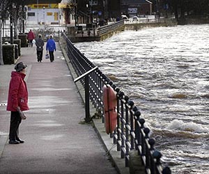
Last week a team of space experts led by British company DMCii participated in a national flooding exercise, "Exercise Watermark", to determine how satellite imagery, satellite communications and satellite navigation could be used to improve UK emergency response. The team represented an ongoing project funded via the UK's Technology Strategy Board (TSB) as part of its contribution to the European Space Agency (ESA) IAP programme.

Exercise Watermark was masterminded by the Environment Agency, on behalf of DEFRA and the Welsh Assembly Government, following recommendations of The Pitt Review into the flooding emergency in June and July 2007 that resulted in 13 deaths and an estimated financial cost of Pounds 3 billion.

During a disaster, space-based services can provide disaster response teams with up-to-date satellite maps and asset tracking capabilities to improve their situational awareness. Damaged or overloaded communications infrastructure on the ground can be reinforced using satellite telecommunications.

British remote sensing company, DMCii, led the team of space experts who observed Exercise Watermark as part of the 'Integrating Space Assets for UK Civil Resilience' project. At the culmination of the 14 month project, the project team will recommend a system using space assets to improve situational awareness for the risks identified in the UK Government's National Risk Register.


SpaceDaily on March 17, 2011
Thu, 17 Mar 2011 - 12:22

Footer menu

  • Contact
  • Terms of Use

User account menu

  • Log in