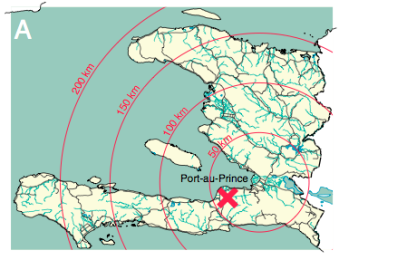
Mobile phones can be used to nowcast and predict population displacement after major disasters. After the devastating 2010 Haiti earthquake, the team of the Swedish NGO Flowminder analyzed the movement of 1.9 million mobile users before and after the earthquake using location data from mobile phones. Even though they had expected the displacement to be hard to predict, the predictability of people’s movements remained high and even increased during the three-month period following the earthquake.
The team just released their findings in a peer-reviewed study entitled: “Predictability of population displacement after the 2010 Haiti earthquake” (PNAS 2012). As the analysis reveals, “the destinations of people who left the capital during the first three weeks after the earthquake was highly correlated with their mobility patterns during normal times, and specifically with the locations in which people had significant social bonds, as measured by where they spent Christmas and New Year holidays”. According to the expert on the application of technology on Disaster Risk Reduction, Patrick Meier, this approach could be used in combination with crowdsourced satellite imagery analysis on the one hand and with Agent Based Models on the other to facilitate emergency response.

