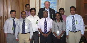
The mission team was lead by two experts from UN-SPIDER and included experts from United Nations Economic and Social Commission for Asia and the Pacific (UNESCAP), United Nations Office Office for the Coordination of Humanitarian Affairs (UNOCHA), the South Asian Association For Regional Cooperation (SAARC) and United Nations Office for Disaster Reduction (UNDRR).
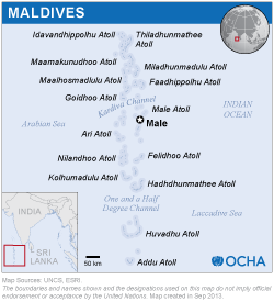
The mission included meetings with the State Minister and Chief Coordinator of the National Disaster Management (NDMC), the Ministry of Health and Family, the Maldives Meteorological Service, and the Department of National Planning. Three UN Country Offices were visited: UNDP, WHO, and UNICEF. The mission also included a one-day workshop bringing together 25 representatives from various governments and UN agencies to discuss cross-cutting issues related to use of geographic and space-based information for disaster risk reduction and emergency response.
- The National Disaster Management Centre (DMC) is fully aware of the potential of space-based information for disaster risk reduction and related cross-cutting issues such as land use planning, environmental planning, coastal zone management, reef management, etc. However, the Maldives is currently not a member of Sentinel Asia;
- The Department of National Planning (DNP) is already using high resolution satellite images to develop base maps of the islands. In addition, DNP has contacts with the Indian Space Research Agency (ISRO) regarding these efforts to use satellite imagery;
- While the Maldives recently opened the DMC, it lacks the technical capacity to use space-based and geographic information. This capacity is required for planning risk reduction activities, which may involve land use mapping, coastal zone mapping, hazard or vulnerability mapping;
- The DNP and the Meteorological Service have GIS capacities, but most other institutions, including the DMC, do not possess such capacities;
- The Spatial Planning Section of the DNP is responsible for developing and maintaining spatial data including satellite images, aerial photographs and vector and raster maps of the country. The section is in the process of consolidating those datasets in the form of National Geographic Information System (GIS);
- The President's Office has developed ISLES, the Provincial Information Management System. ISLES is an interactive programme designed to provide information on the socio-economic activities of each island. In its current form, the ISLES system provides information in the form of narrative reports and data tables. There are also links to generic island maps, which are static PDF maps created by the DNP;
- Several organizations such as the National Building Research Organisation (NBRO) have carried out hazard assessments, and the DMC is promoting the elaboration of risk assessment.
The DMC should establish contacts with Sentinel Asia, with the International Charter: Space and Major Disasters and enhance its links with UN-SPIDER as a way to take advantage of emerging opportunities offered by these mechanisms and by the space community.
The DNP should consolidate the National Geographic Information System (central data warehouse in Male networked with Ministries and all seven provinces). The DNP should establish a Coordination Working Group bringing together experts representing key stakeholders to ensure the sharing and use of geospatial information within Ministries.
The DMC should promote the use of the results of current studies and datasets to support vulnerability analyses and risk reduction activities. Such studies could include: Land use planning, environmental planning, coastal management or coral reef and biodiversity monitoring.
UN-SPIDER and other agencies should assist the DMC and other government institutions in building their capacities to make use of space-based information and geographic information systems in terms of training activities and infrastructure.
The DNP should institutionalize a Working-level Information Management Network. The role of this network would be to build on existing relevant information systems in place in the country and to support the Government's efforts to coordinate and harmonize information management activities, including those of the humanitarian community. The network should aim to be inclusive of all sectors, including both national authorities and international actors. Activities to be carried out by the network should include:
- Agree upon data standards (formats, codes, methodologies, etc.)
- Create of catalog of data to avoid duplication (survey of surveys, etc.)
- Facilitate data sharing
- Share experiences and plan jointly
- Plan joint/coordinated rapid needs assessments