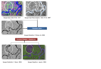
The Agustin Codazzi Geographic Institute (IGAC), host of UN-SPIDER's Regional Support Office in Colombia, conducted a case study to identify flooded areas in Colombia during the maximum rainfall period of the years 2010-2012. This activity was carried out in order to promote the importance of remote sensing techniques and the application of digital satellite imagery for the extraction of flooded areas. The researchers visualized and monitored the behavior of the phenomenon by visual interpretation of optical and radar sensor data.
The digital products derived from the original images characterize and estimate the affected areas by making visible information on geomorphology, geology, topography, hydrology and soil units. These products are the results of the application of processing techniques, such as vegetation indexes and segmentation, the generation of topographic images of aspect or slope, the digital elevation model, and the application of the Adaboost algorithm for detecting changes. The researchers also used techniques of interferometry to generate displacement maps and morphometric maps to identify areas susceptible to flooding. The application of these techniques is being carried out by the group of Remote Sensing and Geographic Applications in remote areas such as the northern part of Antioquia and Valle del Cauca.
| Attachment | Taille |
|---|---|
| Application of the algorithm of change detection in the Cauca River | 148.15 KB |

