The use of Landsat data has exploded since the United States Geological Survey (USGS) began distributing the data at no cost via the internet. In the best sales year, around 25,000 images were sold. The Landsat project has now exceeded that number in a single day. In fact, the 9 millionth image was distributed on September 1, 2012. It has taken less than 4 years to reach this mark, which demonstrates both the temporal and geographic expansion of Landsat-based research, as well as exposure to new communities that are exploring the 40 years of global Landsat data for the first time.
There are several ways to access free Landsat data. The USGS LandsatLook Viewer enables fast and easy viewing of 3 million Landsat images all around the globe with just a simple web browser. With a place name search tool or panning and zooming, users can easily navigate the globe or download full scenes.
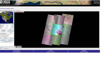
The USGS Global Visualization Viewer allows searching for data by clicking on an interactive map or by entering the geographic coordinates (latitude and longitude). After clicking on the map or entering coordinates, the GloVis view window shows nine adjacent Landsat 7 browse images. This allows the user to visually locate the best Landsat image for their purposes.
Landsat data have been used to monitor water quality, glacier recession, sea ice movement, invasive species encroachment, coral reef health, land use change, deforestation rates and population growth. Landsat has also helped to assess damage from natural disasters such as fires, floods, and tsunamis, and subsequently, plan disaster relief and flood control programs.

