United
Nations
Office for Outer Space Affairs
UN-SPIDER Knowledge Portal
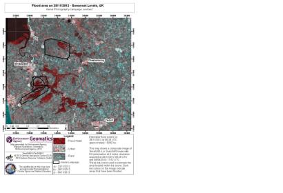
The International Charter "Space and Major Disasters" was activated on 27 November 2012 by the Environment Agency of England and Wales, after widespread floods had hit a number of regions. Among the affected areas are: Somerset levels, Oxford, Tewkesbury, Darlington to York, Nene Washlands, and Nottingham. Approximately 1,800 properties have flooded since last Wednesday, while flood defences have protected more than 54,000 homes. Over 106,000 properties have been sent a flood warning.
After the activation of the Charter, the German TerraSAR-X satellite was tasked to produce flood area maps.
