• English
  • Español
  • Français

United
Nations


Office for Outer Space Affairs
UN-SPIDER Knowledge Portal

  • Accueil
  • À propos
    • Qu'est-ce que l'ONU-SPIDER?
    • À propos d’UNOOSA
    • Publications
    • Offres d'emploi
    • Rencontrez l'équipe
    • Contact
  • Applications spatiales
    • Technologie satellitaire
    • Mécanismes d’urgence
    • Recovery Mechanisms
    • Réseau international d'alerte aux astéroïdes
    • Space Mission Planning Advisory Group
    • Initiative internationale sur la météorologie spatiale
    • Les technologies spatiales à l'ONU
    • Comptes-rendus d'utilisateurs
  • Liens & ressources
    • Application de données du mois
      • Disaster Recovery
    • Sources de données
    • SIG et logiciels de télédétection
    • Online Learning Resources
    • Institutions
  • Risques & catastrophes
    • Prévention des risques de catastrophe
    • Systèmes d'alerte précoce
    • Gestion des catastrophes et des interventions d'urgence
    • Aléas naturels
    • Cadre d'action de Sendai
    • L'ONU et la prévention des risques de catastrophe
    • L'ONU et les alertes précoces
    • L'ONU et la gestion des catastrophes
  • Appui technique
    • Missions Conseil
    • Appui d’urgence
    • Appui à distance
    • Pratiques recommandées
    • Activités de formation
    • Utilisations pratiques
  • Réseaux
    • Bureaux régionaux d’appui
    • GP-STAR
    • MHEWS
    • IWG-SEM
  • Projets
    • SPEAR
    • SEWS-D
    • EvIDENz
    • Flood GUIDE
  • Actualités
    • Actualités
    • Événements
    • Événements passés

Breadcrumb

  • Home
  • Using Cloud-based Geodata Databases For Disaster Response
  • Using cloud-based geodata databases for disaster response

Using cloud-based geodata databases for disaster response

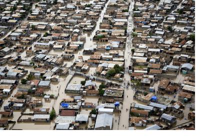
Flooded streets in Haiti in 2010Flooded streets in Haiti in 2010

A real-time demonstration led by the Network Centric Operations Industry Consortium for the US National Geospatial-Intelligence Agency (NGA) has demonstrated the advantages of cloud-based disaster response infrastructure, as the website GCN reported. Via such a cloud-based infrastructure geospatial data can be shared and accessed despite having different IT systems.

GCN reported: "In an effort to improve communication in disaster response, NGA wanted to see how industry can deliver open standards-based geospatial data to first responders via multiple, interoperable cloud infrastructures that would let NGA share nonclassified information with mission partners but protect access to its sensitive information, said David Bottom, director of NGA Information Technology Services. (...) NGA wanted the OpenStack cloud to ensure all geospatial data would be stored in the object-based environment and consumed as a standard Open Geospatial Consortium service, said Todd Myers, NGA’s lead global computer architect."
GCN
Fri, 20 Sep 2013 - 09:08

Footer menu

  • Contact
  • Terms of Use

User account menu

  • Log in