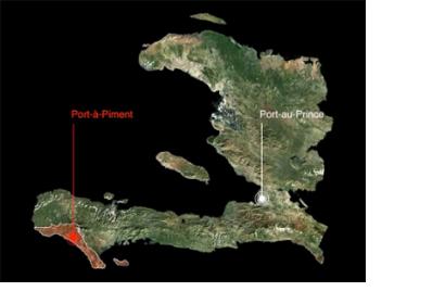
After four years of field research and analytic support provided to the Republic of Haiti and multiple partners there, the Center for International Earth Science Information Network (CIESIN) has launched the Haiti GeoPortal, as CIESIN reported on their website.
CIESIN elaborates: "The Haiti Geoportal is a platform for spatial and environmental data and resources from ongoing research in Haiti as part of the broader Haiti Research and Policy Program at the Earth Institute (EI) at Columbia University.
Featuring an online interactive map component, the Haiti Geoportal is designed to let communities and partners download maps that provide benchmarks for core integrated development indicators, household socio-economic variables, and environmental features. The data covers geographic extents that range from national scale to local communities in Haiti. The Web site contains a data library and a searchable bibliography of materials from the EI and non-EI, including scientific reports and literature and data visualization videos produced to help articulate multi-hazard risk in the watershed of Port-à-Piment.
The Haiti Geo-Portal has been supported by numerous partner organizations and funders. The data has been collected from other organizations and generated from field studies conducted by EI teams through the support of the W.K. Kellogg Foundation, the Haiti Reconstruction Fund via the United Nations Environment Programme (UNEP), the Catholic Relief Services (CRS), the Green Family Foundation, and the Earth Institute."

