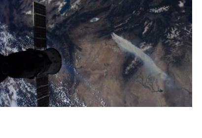
A fire-detecting satellite has been designed by scientists from University of California, Berkeley with the goal of preventing hot spots from growing to out of control fires in the future. Through the use of state-of-the-art sensors and an analysis software to snap pictures of the ground every few seconds, the satellite called the Fire Urgency Estimator in Geosynchronous Orbit (FUEGO), would constantly be searching for hot spots that could become wildfires. The information obtained would allow firefighters to be directed to these hot spots, possibly preventing fires from growing out of control.
“If we had information on the location of fires when they were smaller, then we could take appropriate actions quicker and more easily, including preparing for evacuation,” said fire expert Scott Stephens, a UC Berkeley associate professor of environmental science, policy and management for "News Center". “Wildfires would be smaller in scale if you could detect them before they got too big, like less than an acre,” he added.
The current fire detection methods rely mostly on human spotters in fire towers or on the ground and calls from the public. Consequently Stephens, UC Berkeley astrophysicist, considers satellite technology more efficient and reliable for distinguishing small wildfires before they spread, with few false alarms. Researchers expect that the process of building the FUEGO satellite will begin a year from now, followed by another year of testing before the satellite is finally launched.

