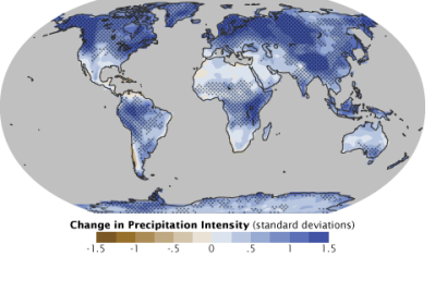
As UN-SPIDER reported, NASA is preparing for the launch of the Global Precipitation Measurement (GPM) satellite in the end of February. The Satellite will be mainly used for rain- and snowfall observation and forecasting.
Scientists of the University of Alabama in Huntsville are conducting basic on the ground research of raindrop and snowflakes sizes and shapes, which they hope will provide a accuracy baseline that is to be scaled up to satellite data. Knowledge of the basic variations of snow- and rainfall will help calibrate the satellite instruments and reduce the error rate for larger areas of observation either by radars or satellite.
The instruments on the satellite – advanced radars and radiometer systems to measure precipitation from space will provide the core of next generation earth observation and fill the observation information gaps left from the ground level reserach. The data collected by the satellite will be validated by the ground research station at the University of Alabama and then used as a reference for other measurements for better understanding of water and energy cycles, for example.
The gathered information will be used globally to improve forecasting of extreme events like storms and floods.

