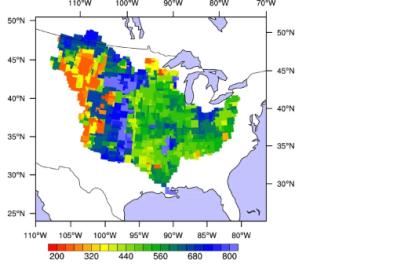
According to new findings from the University of California Irvine the use of satellite data could be used to greatly improve the overflow predictions of a river months before the event occurs which could potentially save lives and property with earlier flood warnings.
Research published in the journal Nature Geoscience sites a case study from NASA’s Gravity Recovery & Climate Experiment mission (GRACE) measuring changes in earth’s gravity due to water storage and saturation. By factoring this data into hydrologic models the total amount of water in a system accounting for groundwater and subsurface accumulations could potentially increase flood warning lead times from two months up to approximately five months.
“GRACE data contain important hydrologic information that is not currently being utilized to estimate regional flood potential… This could significantly increase flood prediction lead times within large river basins,” said J.T. Reager UCI postdoctoral researcher and lead author of the study.
NASA has two GRACE satellites in operation observing monthly variation in total water storage within in river systems.

