![]()
United
Nations
Soil Moisture Data Viewers (TU Vienna)
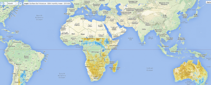
| Data provided by: | GEO Department of Vienna University of Technology |
| Data accessibility: | visualization of data (e.g. web GIS or real time monitoring), web processing/cloud computing |
| Link to the data: | |
| File type: | wms |
| Data type: | hazard specific data |
| Disaster cycle phase: | Disaster Risk Management, Response, Recovery |
| Spatial coverage: | Africa, Latin America and the Caribbean, Australia |
| Spatial resolution: | 1.00 |
| Temporal coverage: | Archive |
| Content dates: | 2004-2010 |
| Costs: | free |
| Restrictions/ Citation of the dataset: | Disclaimer (German) of the TU Vienna
|
Provider
![]()