• English
  • Español
  • Français

United
Nations


Office for Outer Space Affairs
UN-SPIDER Knowledge Portal

  • Accueil
  • À propos
    • Qu'est-ce que l'ONU-SPIDER?
    • À propos d’UNOOSA
    • Publications
    • Offres d'emploi
    • Rencontrez l'équipe
    • Contact
  • Applications spatiales
    • Technologie satellitaire
    • Mécanismes d’urgence
    • Recovery Mechanisms
    • Réseau international d'alerte aux astéroïdes
    • Space Mission Planning Advisory Group
    • Initiative internationale sur la météorologie spatiale
    • Les technologies spatiales à l'ONU
    • Comptes-rendus d'utilisateurs
  • Liens & ressources
    • Application de données du mois
      • Disaster Recovery
    • Sources de données
    • SIG et logiciels de télédétection
    • Online Learning Resources
    • Institutions
  • Risques & catastrophes
    • Prévention des risques de catastrophe
    • Systèmes d'alerte précoce
    • Gestion des catastrophes et des interventions d'urgence
    • Aléas naturels
    • Cadre d'action de Sendai
    • L'ONU et la prévention des risques de catastrophe
    • L'ONU et les alertes précoces
    • L'ONU et la gestion des catastrophes
  • Appui technique
    • Missions Conseil
    • Appui d’urgence
    • Appui à distance
    • Pratiques recommandées
    • Activités de formation
    • Utilisations pratiques
  • Réseaux
    • Bureaux régionaux d’appui
    • GP-STAR
    • MHEWS
    • IWG-SEM
  • Projets
    • SPEAR
    • SEWS-D
    • EvIDENz
    • Flood GUIDE
  • Actualités
    • Actualités
    • Événements
    • Événements passés

Breadcrumb

  • Home
  • ASAL Provides Training Sessions In Remote Sensing And GIS To Sahara And Sahel Countries
  • ASAL provides training sessions in remote sensing and GIS to Sahara and Sahel countries

ASAL provides training sessions in remote sensing and GIS to Sahara and Sahel countries

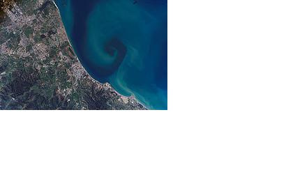
Satellite imagery of the northeastern coast of AlgeriaSatellite imagery of the northeastern coast of Algeria (Image credit: NASA)

From 24 November to 5 December 2014, the Algerian Space Agency ASAL offered two training sessions in remote sensing and GIS at the Observatory of the Sahara and the Sahel (OSS) headquarters in Tunis, Algeria.

Fourteen candidates from seven countries were involved in the activities. Among the participating countries were Burkina Faso, Mali, Mauritania, Niger, Nigeria, Senegal and Chad.

The training forms part of the agreement with the OSS for the realization by ASAL of three observatories dedicated at mapping services for land use. The observatories will be located in Mauritania, Senegal and Chad and will employ high-resolution satellite imagery delivered from Alsat-2A satellite.

The training sessions focused on remote sensing techniques, by introducing participants to satellite imagery processing, and on the use of ArcGIS 10.2.1 software, by using Alsat-2A core images as background for all applications in practical work.

During these two sessions, the role of Alsat-2A imagery in the Sahara and Sahel sub-region was highlighted in relation to issues such as weather monitoring and environmental protection, desertification, agriculture, water resources.

ASAL is also host to the UN-SPIDER Regional Support Office (RSO) in Algeria, which was established as a part of the Central Agency for Civil Protection to address emergencies in North Africa and the Sahel region.
ASAL
Thu, 18 Dec 2014 - 13:42
Algeria Regional Support Office

Footer menu

  • Contact
  • Terms of Use

User account menu

  • Log in