• English
  • Español
  • Français

United
Nations


Office for Outer Space Affairs
UN-SPIDER Knowledge Portal

  • Accueil
  • À propos
    • Qu'est-ce que l'ONU-SPIDER?
    • À propos d’UNOOSA
    • Publications
    • Offres d'emploi
    • Rencontrez l'équipe
    • Contact
  • Applications spatiales
    • Technologie satellitaire
    • Mécanismes d’urgence
    • Recovery Mechanisms
    • Réseau international d'alerte aux astéroïdes
    • Space Mission Planning Advisory Group
    • Initiative internationale sur la météorologie spatiale
    • Les technologies spatiales à l'ONU
    • Comptes-rendus d'utilisateurs
  • Liens & ressources
    • Application de données du mois
      • Disaster Recovery
    • Sources de données
    • SIG et logiciels de télédétection
    • Online Learning Resources
    • Institutions
  • Risques & catastrophes
    • Prévention des risques de catastrophe
    • Systèmes d'alerte précoce
    • Gestion des catastrophes et des interventions d'urgence
    • Aléas naturels
    • Cadre d'action de Sendai
    • L'ONU et la prévention des risques de catastrophe
    • L'ONU et les alertes précoces
    • L'ONU et la gestion des catastrophes
  • Appui technique
    • Missions Conseil
    • Appui d’urgence
    • Appui à distance
    • Pratiques recommandées
    • Activités de formation
    • Utilisations pratiques
  • Réseaux
    • Bureaux régionaux d’appui
    • GP-STAR
    • MHEWS
    • IWG-SEM
  • Projets
    • SPEAR
    • SEWS-D
    • EvIDENz
    • Flood GUIDE
  • Actualités
    • Actualités
    • Événements
    • Événements passés

Breadcrumb

  • Home
  • New Highly Detailed Ecological Land Units Map of The World Published
  • New highly detailed ecological land units map of the world published

New highly detailed ecological land units map of the world published

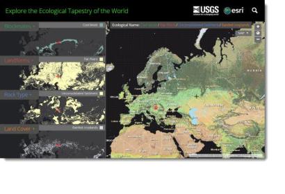
The new global data set provides for a better understanding and accounting of the world’s resources.The new global data set provides for a better understanding and accounting of the world’s resources. (Image: Esri)

Esri and the United States Geological Survey (USGS) recently announced the development of the highest spatial resolution ecological land units (ELUs) map of the world ever produced.

According to the press release "the Global ELUs map portrays a systematic division and classification of ecological and physiographic information about land surface features. The work was commissioned by the intergovernmental Group on Earth Observations (GEO), and published in print by the Association of American Geographers (AAG)."

“This map provides, for the first time, a web-based, GIS-ready, global ecophysiographic data product for land managers, scientists, conservationists, planners, and the public to use for global and regional scale landscape analysis and accounting,” said Roger Sayre from the USGS. “The Global ELU map advances an objective, repeatable, ‘big data’ approach to the synthesis and classification of important earth surface data layers into distinct and ecologically meaningful land units.”
Esri
Tue, 23 Dec 2014 - 07:16

Footer menu

  • Contact
  • Terms of Use

User account menu

  • Log in