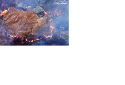
DigitalGlobe latest Earth Observation satellite launched, WorldView-3, includes a shortwave infrared sensor (SWIR) that can see through thick smoke clouds of active fires on the ground. SWIR can thus provide unique and important information for fire response efforts by locating flame fronts and hot spots. What is more is that SWIR can even estimate where the fire is burning the hottest.
On their blog, DigitalGlobe shows the capacities of the SWIR with a slider image of the forest fire burning at the Happy Camp complex in California’s Klamath National Forest in late August. Users can compare a regular image with what SWIR can see.
WorldView-3 currently offers the highest Earth Observation imagery resolution commercially available. SWIR was built by the company Exelis. By the way: DigitalGlobe regularly offers free webinarson satellite image applications and methods.

