United
Nations
Office for Outer Space Affairs
UN-SPIDER Knowledge Portal
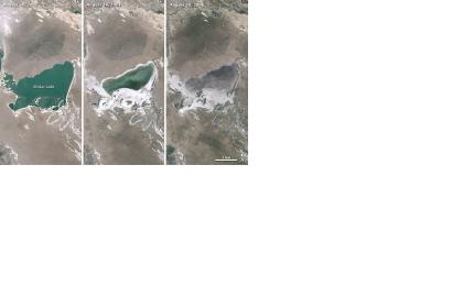
According to researchers from Peking University and the Chinese Academy of Sciences, lakes in the Mongolian Plateau are shrinking rapidly. After analysing several decades of satellite imagery, the researchers found that the total lake surface area had declined from 4,160 square kilometers in the late 1980s to 2,900 square kilometers in 2010, a decrease of 30 percent.
The reasons for this enormous decline are the warming temperatures, decreased precipitation, increased mining and agricultural activity, the study notes. The researchers found that Inner Mongolian lakes shrank even more because of intensive mining and farming activity.
For the study, the researchers reviewed 1,240 scenes captured by the Multispectral Scanner, the Thematic Mapper and the Enhanced Thematic Mapper—each of which is a sensor on a Landsat satellite. The results were published in the Proceedings of the National Academy of the Sciences in February 2015.
