• English
  • Español
  • Français

United
Nations


Office for Outer Space Affairs
UN-SPIDER Knowledge Portal

  • Accueil
  • À propos
    • Qu'est-ce que l'ONU-SPIDER?
    • À propos d’UNOOSA
    • Publications
    • Offres d'emploi
    • Rencontrez l'équipe
    • Contact
  • Applications spatiales
    • Technologie satellitaire
    • Mécanismes d’urgence
    • Recovery Mechanisms
    • Réseau international d'alerte aux astéroïdes
    • Space Mission Planning Advisory Group
    • Initiative internationale sur la météorologie spatiale
    • Les technologies spatiales à l'ONU
    • Comptes-rendus d'utilisateurs
  • Liens & ressources
    • Application de données du mois
      • Disaster Recovery
    • Sources de données
    • SIG et logiciels de télédétection
    • Online Learning Resources
    • Institutions
  • Risques & catastrophes
    • Prévention des risques de catastrophe
    • Systèmes d'alerte précoce
    • Gestion des catastrophes et des interventions d'urgence
    • Aléas naturels
    • Cadre d'action de Sendai
    • L'ONU et la prévention des risques de catastrophe
    • L'ONU et les alertes précoces
    • L'ONU et la gestion des catastrophes
  • Appui technique
    • Missions Conseil
    • Appui d’urgence
    • Appui à distance
    • Pratiques recommandées
    • Activités de formation
    • Utilisations pratiques
  • Réseaux
    • Bureaux régionaux d’appui
    • GP-STAR
    • MHEWS
    • IWG-SEM
  • Projets
    • SPEAR
    • SEWS-D
    • EvIDENz
    • Flood GUIDE
  • Actualités
    • Actualités
    • Événements
    • Événements passés
  • Admin
    • SAM Items

Breadcrumb

  • Home
  • Earth’s Biggest Geological Fault Explained
  • Earth’s biggest Geological fault explained

Earth’s biggest Geological fault explained

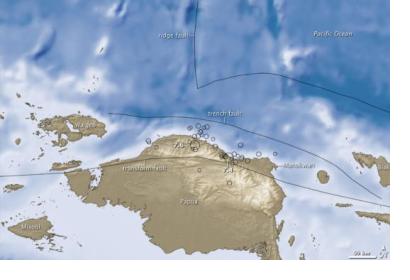
2009 earthquake in Papua, Indonesia. Image: courtesy of NASA2009 earthquake in Papua, Indonesia. Image: courtesy of NASA

Geologist from the Australian National University (ANU) documented how the Banda Detachment fault in eastern Indonesia formed and works. This finding will help to evaluate the dangers of future tsunamis in the area that is part of the Pacific Ring of Fire, known for frequent earthquakes and volcanic eruptions.

Dr Jonathan Pownall, leader of the research, confirmed that “a 7km-deep abyss beneath the Banda Sea off eastern Indonesia was formed by extension along what might be Earth’s largest-identified exposed fault plane.”

ANU researchers worked together with Royal Holloway University of London experts analyzing high-resolution maps of the Banda Sea floor and found rocks flooring the seas are cut by hundreds of straight parallel scars. The marks show that the missing crust is bigger than a country like Tasmania or Belgium and it was torn apart by 120 km of extension along a detachment fault which formed the ocean-floor depression.

The findings will contribute to evaluate future possible hazards like earthquakes and tsunamis which are frequent in the region. For more information please click here. 
Biggest exposed fault on Earth discovered
Tue, 6 Dec 2016 - 07:28
Indonesia

Footer menu

  • Contact
  • Terms of Use

User account menu

  • Log in