• English
  • Español
  • Français

United
Nations


Office for Outer Space Affairs
UN-SPIDER Knowledge Portal

  • Accueil
  • À propos
    • Qu'est-ce que l'ONU-SPIDER?
    • À propos d’UNOOSA
    • Publications
    • Offres d'emploi
    • Rencontrez l'équipe
    • Contact
  • Applications spatiales
    • Technologie satellitaire
    • Mécanismes d’urgence
    • Recovery Mechanisms
    • Réseau international d'alerte aux astéroïdes
    • Space Mission Planning Advisory Group
    • Initiative internationale sur la météorologie spatiale
    • Les technologies spatiales à l'ONU
    • Comptes-rendus d'utilisateurs
  • Liens & ressources
    • Application de données du mois
      • Disaster Recovery
    • Sources de données
    • SIG et logiciels de télédétection
    • Online Learning Resources
    • Institutions
  • Risques & catastrophes
    • Prévention des risques de catastrophe
    • Systèmes d'alerte précoce
    • Gestion des catastrophes et des interventions d'urgence
    • Aléas naturels
    • Cadre d'action de Sendai
    • L'ONU et la prévention des risques de catastrophe
    • L'ONU et les alertes précoces
    • L'ONU et la gestion des catastrophes
  • Appui technique
    • Missions Conseil
    • Appui d’urgence
    • Appui à distance
    • Pratiques recommandées
    • Activités de formation
    • Utilisations pratiques
  • Réseaux
    • Bureaux régionaux d’appui
    • GP-STAR
    • MHEWS
    • IWG-SEM
  • Projets
    • SPEAR
    • SEWS-D
    • EvIDENz
    • Flood GUIDE
  • Actualités
    • Actualités
    • Événements
    • Événements passés

Breadcrumb

  • Home
  • CONAE Assessing The Extent of Forest Fires In Argentina
  • CONAE assessing the extent of forest fires in Argentina

CONAE assessing the extent of forest fires in Argentina

Hotspots related to the forest fires in January 2017.   Courtesy of CONAE.Hotspots related to the forest fires in January 2017. Courtesy of CONAE.

Argentina’s National Commission on Space Activities (CONAE) is contributing to the assessment of the forest fires in the Rio Negro, La Pampa and Buenos Aires provinces in Argentina.  Researchers at the Unit for National Emergencies (CAEARTE) in the Teofilo Tabanera Space Centre of CONAE in Cordoba are generating maps depicting those regions affected by the forest fires.  The forest fires began at the end of December 2016.  The MODIS satellite imagery of 4 January 2017 allowed researchers to estimate that nearly 910,000 hectares have been affected by forest fires.  The International Charter Space and Major Disasters was activated to contribute to map the areas affected by these forest fires.

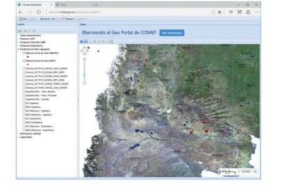
Maps depicting the hotspots related to these forest fires can be viewed using CONAE's Geo Portal.   The geo-viewer can be accessed through this link:  https://geoportal.conae.gov.ar/geoexplorer/composer/.   CAEARTE researchers are testing an experimental procedure to assess the risk of fire.  

More information on activities conducted by CONAE related to these forest fires can be found in this link:  http://www.conae.gob.ar/index.php/espanol/2017
Wed, 11 Jan 2017 - 00:21
Argentina
Argentina Regional Support Office

Footer menu

  • Contact
  • Terms of Use

User account menu

  • Log in