Argentina

country taxonomy block

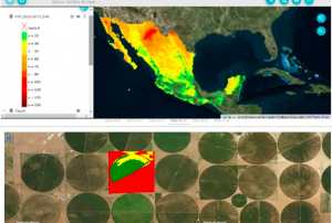
In collaboration with the National Commission for Space Activities (CONAE) of Argentina, the Mexican Space Agency (AEM) recently launched a digital platform to improve the integration of satellite data for environmental monitoring in Latin America. The Comprehensive Regional Satellite Information System (SIRIS) provides access to satellite information in order to enhance decision-making and facilitate disaster management.

The SIRIS platform provides access to satellite imagery for different areas. The platform supplies information on the agriculture and forestry sector to better monitor the impact of natural disasters on agricultural production and woodland. It also offers up-to-date and archived data on fires to strengthen early warning and build long-term resilience. On floods, information provided by SIRIS indicates the water level to improve damage evaluation of the impacted area and facilitate humanitarian relief. In…

more
Publishing date 20/12/2020
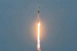
The Argentinean SAOCOM 1B satellite [was successfully launched](https://www.argentina.gob.ar/noticias/argentina-lanzo-el-satelite-saocom-1b-y-completo-la-mision-espacial-mas-importante-del-pais) into orbit on 30 August 2020. Developed by the National Argentinean Space Commission (CONAE), this new satellite will join SAOCOM 1A and four Italian COSMO-SkyMed to complete the joint Italian-Argentinean Satellite System for Emergency Management (SIASGE). Like its predecessor, SAOCOM 1B was built in Argentina through a joint effort with private companies and universities. It will operate at an elevation of 620 kilometers above the surface of the Earth. A SpaceX Falcon 9 booster launched the satellite from Space Launch Complex 40 at Cape Canaveral Air Force Station in Florida, United States of America. The SAOCOM 1B satellite has been fitted with a Synthetic Aperture Radar (SAR) sensor that makes use of microwaves in the electromagnetic L-band, which goes through clouds and works without… more
Publishing date 14/09/2020
Regional Support Offices mentioned:

The Argentina National Space Activities Commission (CONAE) launched a new Earth observation satellite that will support disaster management efforts. SAOCOM 1A is the first of a constellation of two radar satellites. The remote sensing mission aims to provide timely information for disaster management as well as monitoring services for agriculture, mining and ocean applications.

The SAOCOM 1A uses L-band Synthetic Aperture Radar (SAR). The mission, which also plans to launch the SAOCOM 1B in 2019, was designed to work within the Italian-Argentinian satellite system for Emergency response (SIASGE), where the two space agencies work together. Argentina’s  SAOCOM and Italy’s COSMO-SkyMed constellations complement each other. The later uses X-band and is designed to collect fine details. Other particularities linked to the SEACOM 1A are related to the heating system since the use of L-band implies that the structure needs to distribute the heat across the antenna.

“You…

more
Publishing date 09/10/2018
Regional Support Offices mentioned:

The International Charter Space and Major Disasters has been activated for floods in Argentina and Bolivia.

River burst its banks in Salta Province

Heavy rains in the region caused the Pilcomayo river to overflow, leading to displacement of the local population and widespread damages. The river rises in the Andes in Bolivia and flows along the border between Argentina and Paraguay before joining the Paraguay river opposite Asunción.

The activation has been requested by the National Civil Protection Directorate of Argentina. The National Space Activities Commission (CONAE), a UN-SPIDER Regional Support Office, acts as the project manager for this activation.

Record rains cause flooding in several departments of Bolivia

Local authorities in Bolivia have declared a state of emergency for several departments affected by heavy rains. Disaster response teams indicated that around 50,000 citizens are being reallocated to shelters.

The overflow of…

more
Publishing date 08/02/2018
Regional Support Offices mentioned:

The Cultural Center of Science in Buenos Aires hosted a meeting organized by the Argentine Space Agency (CONAE) and the European Space Agency (ESA) to present the uses of their satellite missions to the users of space-based information.

The meeting showed the cooperation efforts between the two agencies and their joint projects as well as their own satellite missions, earth observation programmes and services. CONAE presented their SAOCOM mission, which uses the Synthetic Aperture Radar (SAR) data and can be used in e.g. in agriculture, hydrology, hazard mapping or urban monitoring. More information about the mission is available here: http://www.conae.gov.ar/index.php/english/satellite-missions/saocom/introduction Representatives from ESA presented the Copernicus programme for earth observation and the use of the data from the Sentinel satellites. More about Copernicus can be…

more
Publishing date 15/05/2017
Regional Support Offices mentioned:
Argentina’s National Commission for Spatial Activities (CONAE) participated in agricultural trade fair Expoagro held on 7-11 March 2017 in Buenos Aires. The agency presented their SAOCOM mission to potential users there. SAOCOM Earth’s observation mission uses SAR (Syntetic Aperture Radar) information to generate products that can be used in agriculture and hydrology, e.g. soil moisture maps. In particular, the satellite imagery products can help the farmers in decision-making related to crop cultivation like sowing, fertilization and irrigation. They can also improve the risk management in case of hydrology emergency events and therefore minimize the losses.
The agency’s team presented a series of talks on the fair, including “CONAE and its satellites”, “Examples of benefits for the rural environment”, “Satellite information for agricultural produce: Benefits to hydrology of agricultural valleys” and others. All can…
more
Publishing date 23/03/2017
Regional Support Offices mentioned:

Argentina’s National Commission on Space Activities (CONAE) is contributing to the assessment of the forest fires in the Rio Negro, La Pampa and Buenos Aires provinces in Argentina.  Researchers at the Unit for National Emergencies (CAEARTE) in the Teofilo Tabanera Space Centre of CONAE in Cordoba are generating maps depicting those regions affected by the forest fires.  The forest fires began at the end of December 2016.  The MODIS satellite imagery of 4 January 2017 allowed researchers to estimate that nearly 910,000 hectares have been affected by forest fires.  The International Charter Space and Major Disasters was activated to contribute to map the areas affected by these forest fires.

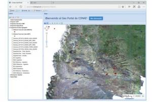
Maps depicting the hotspots related to these forest fires can be viewed using CONAE's Geo Portal.   The geo-viewer can be accessed through this link:  https://geoportal.conae.gov.ar/…

more
Publishing date 11/01/2017
Regional Support Offices mentioned:

The International Charter Space and Major Disasters was activated on 5 January 2017 at the request of the National Civil Protection Secretariat of Argentina (SIFEM) due to wild fires in Buenos Aires, the Central province of Pampa and the southern province of Rio Negro.  According to the news paper La Nacion of Argentina (http://www.lanacion.com.ar/1972677-las-impresionantes-imagenes-de-la-nasa-de-los-incendios-que-afectan-la-pampa-rio-negro-y-el-sur-bonaerense), the fires have  destroyed vasts amounts of forests in recent weeks in these provinces. Nevertheless,the fires in the southern region of La Pampa wetre controlled by the end of the first week of January 2017. 

NASA captured images of these forest fires using the Operational…

more
Publishing date 07/01/2017

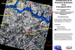
The Argentinean Space Agency (CONAE), UN-SPIDER’s Regional Support Office, has provided satellite data to monitor major flooding caused by the overflow of the Areco and Luján rivers in the province of Buenos Aires.

CONAE is supporting the institutions and organisms in charge of the mitigation activities through satellite images, which show the environmental situation of the covered areas. These images follow a rigorous process of downloading, preprocessing, examination, processing and final elaboration.  

Moreover, CONAE has activated the International Charter: Space and Major Disasters together with the SIFEM-DNPC (Sistema Federal de Emergencias - Dirección Nacional de Protección Civil) in order to receive satellite-based …

more
Publishing date 13/08/2015
Regional Support Offices mentioned:

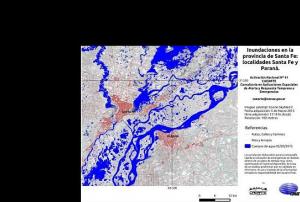
The Argentinean National Space Activities Commission (CONAE) has been producing information about recent floods based on radar satellite images. In March, the provinces of Santa Fe and Santiago del Estero suffered from intense floods.

Satellite imagery of the affected areas has served as support for the efforts of national institutions and organisms to mitigate the damages. The imagery was obtained from the Italian Cosmo SkyMed mission as well as from Landsat and SPOT5 satellites.

According to the newspaper La Nación, the floods in Santa Fe and Santiago del Estero were caused by an unusual amount of rainfall in the central area of the country that forced more than 5000 to evacuate and killed 10. It also caused a collapse of the vital infrastructures and daily activities. The rural areas are the most affected with more than 500,000 hectares of crops destroyed.

more
Publishing date 31/03/2015
Regional Support Offices mentioned:

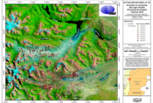
The Argentinian National Space Activities Commission (CONAE), host to a UN-SPIDER Regional Support Office, is providing heat spotlight maps based on satellite images that show the environmental conditions of the Andean-Patagonian native forests, which is crucial information to mitigate the fires in the province of Chubut, Argentina.

The maps are based on data from NASA's Landsat, Terra and Aqua satellites. The data is downloaded to, and pre-processed in the Earth Station Space Center Teófilo Tabanera (CETT). After a quality check, the images are delivered to professional staff of Space Applications Consulting area in Early Alert and Response to Emergencies (CAEARTE), for processing and last preparations. Finally, all information is sent to the authorities responsible for the mitigation of emergency, such as the Technical…

more
Publishing date 04/03/2015
Regional Support Offices mentioned:

The National Commission for Space Activities (CONAE), UN-SPIDER's Regional Support Office in Argentina, presented an extensive satellite-based map of the province of Tucumán, Argentina. This is a unique effort assembling satellite images and topographic cartography in 1:100.000 scales. The project was presented on 23 June 2014 at the Government House of the Tucumán province, Argentina, in the presence of national and regional authorities, professionals and students of primary schools.

Atlas Tucumán 100K was created by the National geographic Institute (IGN), CONAE, the Institute for Geographic Studies of the National University of Tucumán and the Regional Ministry for Education. This up-to-date work joins geography and spatial technology to the educational system, giving continuity to the work started with Atlas Argentina 500K, in its editions of 2010 and 2011.

The atlas contains topographic maps and satellite imagery, as well as high resolution aerial photography…

more
Publishing date 11/07/2014
Regional Support Offices mentioned:

On 14 June 2014 the International Charter: Space and Major Disasters was activated at the request of the Brazilian Disaster Risk Management National Centre (CENAD) in response to flooding and landslides caused by heavy rainfall from 07 and 10 of June 2014 affecting the states of Santa Catarina and Parana.

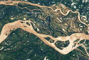
Due to the flooding and landslides ten people have died and six are still reported as missing, an estimated 40,000 people have been evacuated and 130 cities have been affected. Flooding of the Parana River has impacted not only Brazil but Argentina and Paraguay as well.

Satellite-based products and maps created through the mechanism will be published on the International Charter's website as soon as they become available.

Additionally to the efforts of the International Charter, the crowdsource mapping organization MapAction has deployed volunteers to…

more
Publishing date 17/06/2014

The Argentina National Space Activities Commission (CONAE) became UN-SPIDER's most recent Regional Support Office (RSO). CONAE and UNOOSA signed a cooperation agreement to establish the Regional Support Office in 2012. CONAE has been promoting the use of space-based information within Argentina and in Latin America for a variety of purposes and has been supporting UN-SPIDER in activities conducted in Latin America and the Caribbean. As a member of the International Charter: Space and Major Disasters, CONAE has supported emergency response efforts in many countries of the region. As an RSO, CONAE continues to provide experts for UN-SPIDER's technical advisory support to countries within the region and contributes to capacity building efforts in the region.

more
Publishing date 02/10/2012
Regional Support Offices mentioned:
The Summit will be held in Buenos Aires, Argentina September 3-8, 2017 at the Intercontinental Hotel Buenos Aires. The Summit affords a unique opportunity to strengthen our collective ability to meet the multiple challenges of disaster risk reduction (DRR) in the Americas with an overarching approach to promote the use of earth observation (EO). Please visit the Summit website to register and obtain more information about the Summit, including the proposed agenda, disaster simulation exercise, capacity trainings, poster session and more. Due to the high degree of interest and diverse stakeholder participation, interested parties are asked to please apply to attend by August 13, 2017. A limited number of hotel rooms is… more

The International Academy of Astronautics is holding its 2nd symposium on small satellites, with a focus on advanced technologies and distributed systems. The symposium will have a worldwide vision, with some focus on the needs and developments of Latin America. 

Applications to present a paper at the conference are being accepted. In order to apply, candidates are asked to submit a one-page, single-spaced abstract of no less than 350 and no more than 600 words. The abstract must be in English, and student papers are encouraged. 

Papers covering advanced technologies and distributed platforms and/or payloads themes are recommended, but all topics related to small satellite missions will be considered. Presentations during the symposium will preferably be in English, however, presentations in Spanish will be considered.

The deadline for abstract submission is 16 September 2019. Papers are due by 15 November 2019. 

To register for the symposium and pay the…

more

FICHA TÉCNICA DE LA CARRERA:

  • Denominación: Maestría en Geomática aplicada la gestión de riesgos ambientales.
  • Tipo de carrera de Posgrado: Maestría Profesional.
  • Duración: dos años.
  • Resolución de aprobación en UADER: 1461/12.
  • Expediente CONEAU: Nº 0001381/12. Número de Orden CONEAU: 11.210/12.
  • Resolución Aprobación Ministerio de Educación: Nº 11.210/12.
  • Modalidad: Presencial. Estructurada.
  • Sede de dictado: CeReGeo-FCyT / CICyTTP CONICET Diamante (Diamante , Entre Ríos, Argentina)
  • Organización del plan de estudios: Ciclo Introductorio. Ciclo Básico. Ciclo Específico. Trabajo Final de Maestría.
  • Carga horaria total: 740 horas.
  • Admisión: BIENAL
  • Preinscripción: Hasta el 16 de Noviembre de 2015.
  • Inicio de los cursos: Junio/Julio de 2016. (un curso por mes de 4 ó 5 días de duración, según corresponda)

Organized by OSGeo and with more than 15 years of experience, this international anual gathering of location enthusiasts is the largest global gathering for geospatial software.

FOSS4G brings together developers, users, decision-makers and observers from a broad spectrum of organizations and fields of operation. Through six days of workshops, presentations, discussions, and cooperation, FOSS4G participants create effective and relevant geospatial products, standards, and protocols.

The 2021 edition will be focused for the first time on South America with the close collaboration of the GeoLibres Association in Buenos Aires, Argentina.

A FOSS4G with focus on the City of Buenos Aires undoubtedly marks a milestone in the calendar of international conferences. The city is a cultural benchmark in the region, making it a great opportunity to bring the free software communities of South America closer together. This approach will help strengthen ties between…

more