  • English
  • Español
  • Français

United
Nations


Office for Outer Space Affairs
UN-SPIDER Knowledge Portal

  • Home
  • About Us
    • What is UN-SPIDER?
    • About UNOOSA
    • Publications
    • Jobs
    • Meet the Team
    • Contact
  • Space Application
    • Satellite Technology
    • Emergency Mechanisms
    • Recovery Mechanisms
    • International Asteroid Warning Network
    • Space Mission Planning Advisory Group
    • International Space Weather Initiative
    • Space Technologies in the UN
    • User Stories
  • Links & Resources
    • Data Applications
      • Disaster Recovery
    • Data Sources
    • GIS and Remote Sensing Software
    • Online Learning Resources
    • Institutions
  • Risks & Disasters
    • Disaster Risk Management
    • Early Warning Systems
    • Emergency and Disaster Management
    • Natural Hazards
    • Sendai Framework
    • The UN and Disaster Risk Management
    • The UN and Early Warning
    • The UN and Disaster Management
  • Advisory Support
    • Advisory Missions
    • Emergency Support
    • Virtual Advisory Support
    • Recommended Practices
    • Training Activities
    • Practical Uses
  • Network
    • Regional Support Offices
    • GP-STAR
    • MHEWS
    • IWG-SEM
  • Projects
    • SPEAR
    • SEWS-D
    • EvIDENz
    • Flood GUIDE
  • News & Events
    • News
    • Events Calendar
    • UN-SPIDER Events Archive
  • Admin
    • SAM Items

Breadcrumb

  • Home
  • Links and Resources
  • Data Applications
  • Data Applications

Data Applications

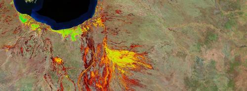
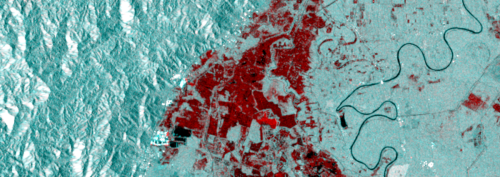
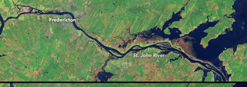
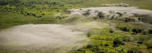
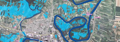
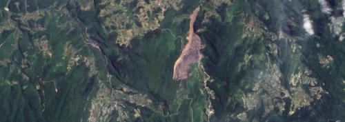
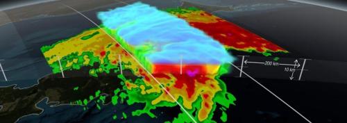
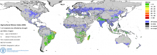
Satellite-derived data relevant for disaster risk reduction and emergency response is available from many sources and providers. The UN-SPIDER database on satellite data and products offers links to datasets of satellite imagery, elevation models, land use and land cover maps as well as near real-time data products for different hazard types. But how can these datasets be used for particular hazards? How are datasets combined, and why is the information they provide so vital in the context of disaster management?

To highlight areas where space-based information is used to support disaster management efforts, the UN-SPIDER team compiles an overview of relevant applications of space-based data on a monthly basis. The Data Applications provide background information on specific hazards and how they can be monitored from space and links to related data sets and information products.

Data Application Of The Month: Earth Observation Data Cubes
Data Application of the Month: Machine Learning for Flood Detection
Data Application of the Month: River Flooding
Data Application of the Month: SDIs and Geospatial Data Management
Data Application of the Month: Locust Monitoring
Data Application of the Month: Land Degradation
Data Application of the Month: Soil Erosion
Data Application of the Month: Overview of Web Maps for Flood Monitoring
Data Application of the Month: Land Deformation Mapping Using DInSAR
Data Application of the Month: Harmful Algal Blooms
Data Application of the Month: Oil Spill Mapping
Data Application of the Month: Water Quality Monitoring
Data Application of the Month: Population and Settlement Data
Data Application of the Month: Free Satellite Data
Data Application of the Month: Forest Fires
Data Application of the Month: Emergency Response
Data Application of the Month: Landslides
Data Application of the Month: Precipitation
Data Application of the Month: Drought Monitoring
Data Application of the Month: Vegetation Indices
Data Application of the Month: Digital Elevation Models
Data Application of the Month: Mapping Land Cover

Footer menu

  • Contact
  • Terms of Use

User account menu

  • Log in