English
Español
Français
Search form
Search
Menu
Main menu
Home
Space Application
Emergency Mechanisms
International Asteroid Warning Network
International Space Weather Initiative
Satellite Technology
Space Technologies in the UN
User Stories
Risks & Disasters
Disaster Risk Management
Early Warning Systems
Emergency and Disaster Management
Natural Hazards
The UN and Early Warning
The UN and Disaster Risk Management
The UN and Disaster Management
Sendai Framework
Links & Resources
Countries
Institutions
Data Application of the Month
Data Sources
External In Person Training Opportunities
External Online Training Opportunities
GIS and Remote Sensing Software
Advisory Support
Advisory Missions
Emergency Support
Recommended Practices
Remote support
Training Activities
Network
GP-STAR
IWG-SEM
MHEWS
Regional Support Offices
Projects
EvIDENz
SEWS-D
SPEAR
News & Events
Events Calendar
UN-SPIDER Events Archive
Monthly Updates
News
Newsletter
About Us
What is UN-SPIDER?
About UNOOSA
Publications
Jobs
Meet the team
Contact
UN-SPIDER contributes to virtual training on the use of Google Earth Engine for forest fire management
Image: NASA Worldview.
UNOOSA and UNDRR conduct conference on space-based technologies for disaster risk reduction
Typhoon Vamco on November 11, a few hours before making landfall on the Philippines. Image: NASA.
UN-SPIDER supports disaster response efforts to Hurricane Eta in Central America
The Geostationary Operational Environmental Satellite 16 (GOES-16) captured this image of Eta on November 3. Image: NASA Earth Observatory.
UNOOSA and Centre for Space Science and Technology Education for Asia and the Pacific launch online course on Geospatial Applications for Disaster Risk Management
Floods in northern parts of Madagascar in late January 2020. Image: NASA.
UNOOSA and Ben-Gurion University of the Negev agree to establish UN-SPIDER RSO in Israel
Image: Ben-Gurion University of the Negev.
Previous
Pause
Next
1
of
5
Explore the Knowledge Portal
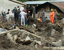
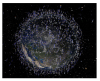
How can space technology be applied in disaster and risk management?
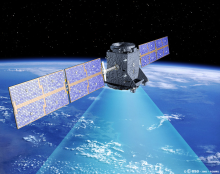
Where can I access satellite data, products and other resources?
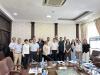
Who are the users of space technology in disaster and risk management?
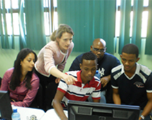
Which services can UN-SPIDER offer to Member States?
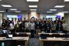
Stay up to date
News
Mon Jan 11 2021
UNOOSA and NASA sign landmark Memorandum of Understanding to advance peaceful...
Fri Jan 8 2021
EUMETSAT releases new pilot data services
Wed Jan 6 2021
Copernicus releases 30m Digital Elevation Model
Mon Jan 4 2021
UN-SPIDER contributes to virtual training on the use of Google Earth Engine for...
Sun Dec 20 2020
Mexico and Argentina align satellite networks to resolve regional challenges
Upcoming Events
21/01/2021
Virtual launch of Atlas of Human Planet 2020
21/01/2021
AI for good Webinar: Towards Responsible AI for Disaster Risk Management
03/02/2021
Digital Earth Africa Webinar: Capacity Development for Using EO Data to Drive...
08/02/2021 to 05/03/2021
Taller Gestión de Incendios Forestales Mediante el Uso de la Plataforma Google...
09/02/2021
Mapping and Monitoring Lakes and Reservoirs with Satellite Observations
Connect to the community
Our Regional Support Offices
Zircon - This is a contributing Drupal Theme
Design by
WeebPal
.