China

country taxonomy block

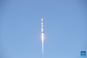
On June 20, China successfully launched a new space experimental astellite, Shiyan-25, from the Taiyuan Satellite Launch Center in the northern province of Shanxi. The satellite will mainly be used to conduct new Earth observation technology experiments, covering areas such as disaster prevention and mitigation, urban planning, and land resource surveys.

Main image: A Long March-6 carrier rocket carrying the Shiyan-25 experiment satellite blasts off from the Taiyuan Satellite Launch Center in north China's Shanxi Province, June 20, 2023 © Photo by Zheng Bin / Xinhua

more
Publishing date 21/06/2023

A new Earth-observation satellite was successfully launched by China on Thursday, 7th April 2022, from the Jiuquan Satellite Launch Center in the north-western part of the country.

Long March-4C rocket launched Gaofen-3 03 at 7:47 a.m. (Beijing Time) and it went into orbit as planned.

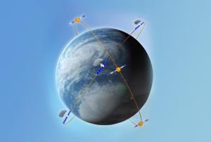
Together with two satellites from the Gaofen-3 series that have already been launched, the three will work together to make a "sky eye" in space.

The three satellites are all on the same orbital plane, and they work together to be more efficient by going around the Earth every 99 minutes.

To assist China's maritime development, environmental resource monitoring, and disaster prevention and mitigation, the design will increase the number of times satellites view the Earth, improve their revisiting capabilities, and expand worldwide coverage.

The Gaofen-3 02 and 03 include an auto-identification system (AIS) and other improvements over the first satellite of its…

more
Publishing date 14/04/2022

On Sunday, 27 February, China launched a Long March-4C rocket, carrying a new land observation satellite into space. 

The new satellite L-SAR 01B will be used to monitor Earth's geological environment, landslides, and earthquakes. Being part of the L-SAR satellite group, it will complete the mission that we have reported on earlier this year: "Chinese remote-sensing satellite L-SAR 01A started taking pictures and transmitting observation data"

Additionally, as reported by Xinhuanet News, China launched a Long March-8 rocket with 22 satellites on the same date, setting a new domestic record for the most spacecraft launched by a single rocket. According to the Xinhua report, these satellites will be used for commercial remote…

more
Publishing date 07/03/2022

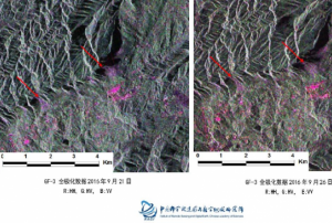
On 26 January, China launched a Long March-4C carrier rocket, placing the L-SAR 01A satellite in space. Equipped with L-band synthetic aperture radar (SAR), the satellite can be used for monitoring the geological environment, especially for landslide and earthquake monitoring.

On 12 February, the satellite was able to take the first quality pictures from space. By the end of February 2022, L-SAR 01B will be launched, completing the L-SAR satellite group of China. The radar was designed, and the images are being received by the Aerospace Information Research Institute under the Chinese Academy of Sciences (CAS).

Being a microwave-imaging radar system, emitting electromagnetic waves to Earth and receiving its echoes, the system is able to take all-weather and round-the-clock microwave pictures of the land surface.

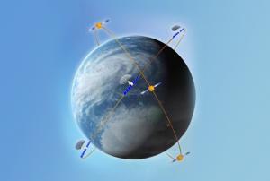
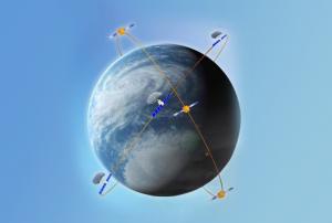
Image: A demonstration of China's geological environment and disaster monitoring and forecasting satellite constellation,…

more
Publishing date 17/02/2022
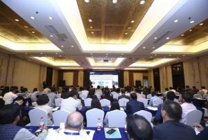
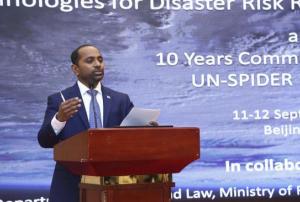
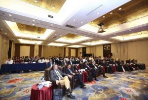
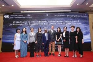
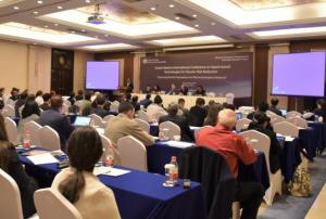
Participants at the UN-SPIDER Beijing conference. , Head of the UN-SPIDER Beijing office, Shirish Ravan, addresses the audience. , Participants at the UN-SPIDER Beijing conference. , Participants at the UN-SPIDER Beijing conference. ,

The Sendai Framework for Disaster Risk Reduction 2015-2030 recognizes the importance of a multi-hazard approach to disaster risk reduction and makes explicit reference to promoting real-time access to reliable data making use of space and in situ information under Priority for Action 1, “Understanding disaster risk”. Such access is key to developing an understanding of disaster risk in all its dimensions including exposure of persons and assets, hazard characteristics and the environment. This knowledge can be leveraged for risk assessments, and improved planning and preparedness.

The use of space-based technologies and Earth observation, especially because of their contribution to understanding risks, are essential elements in developing evidence-informed national and local disaster risk reduction strategies. Under its Target E, the Sendai Framework calls on United Nations Member States to substantially “increase the number of countries with national and local disaster risk…

more
Publishing date 13/09/2019

On 10 September 2019, 60 participants of the ninth annual UN-SPIDER Beijing conference and officials from Chinese government organizations attended the International Charter “Space and Major Disasters” project manager training.

The training was co-organized by the UN-SPIDER Beijing office and the National Disaster Reduction Centre of China (NDRCC) and hosted at the facilities of NDRCC in Beijing. The China National Space Administration (CNSA) supported the training in the capacity of member of the International Charter. The training was conducted by experts from the National Centre for Space Studies (CNES) of France and the Center for Resources Satellite Data and Applications (CRESDA) of China.

The unique feature of this project manager training was that several disaster management officials of several developing countries attended the training and understood importance of the International Charter in their functions.

Publishing date 12/09/2019

In the run up to this year's UN-SPIDER Beijing conference on 11 and 12 September, 30 participants from around Asia attended the international training programme on space-based technologies for disaster risk assessment from 5 to 9 September, which was hosted at the Regional Centre for Space Science Technology Education in Asia and the Pacific (RCSSTEAP) based at Beihang University, Beijing. The training was co-organised by UNOOSA and its UN-SPIDER Beijing office, the Asia Pacific Space Cooperation Organisation (APSCO) and the National Disaster Reduction Centre of China. Experts from the National Disaster Reduction Centre of China, Delta State University, the International Water Management Institute and Airbus, Supermap and UN ESCAP conducted the lectures and hands-on sessions.

The training covered following topics: Application of UAV remote sensing in disaster monitoring and loss assessment, automatic interpretation of high-resolution remote sensing images based on deep…

more
Publishing date 12/09/2019
Regional Support Offices mentioned:

The United Nations Office for Outer Space Affairs (UNOOSA) has opened registrations for the 9th Annual UN-SPIDER Conference in Beijing “United Nations International Conference on Space-based Technologies for Disaster Risk Reduction – ‘A Policy Perspective’”. The registration deadline is 15 July 2019.

The conference, which will take place 11-12 September 2019, will also celebrate 10 years of the United Nations Platform for Space-based Information for Disaster Management and Emergency Response (UN-SPIDER) in Beijing, China.

The occasion will be used for acknowledging the achievements of the countries and efforts of its partners in utilizing space-based and geospatial information in disaster management and emergency response.

The…

more
Publishing date 13/05/2019

After completing in-orbit tests, China officially put two new Earth observation satellites into operation on 21 March. As new part of China’s High-definition Earth Observation Satellite (CHEOS), Gaofen-5 and -6 will aid in environmental protection, agricultural and forestry surveys and disaster relief.

Gaofen-5 and -6 will improve China’s capability to receive ground images and data, thereby facilitating social, economic and environmental development, stated Zhang Kejian, director of the China National Space Administration (CNSA). After launching Gaofen-7 later this year, China will complete the construction of CHEOS with multiple high-definition satellites, Keijan said.

During the testing period of several months, the two satellites provided data on natural resources, environmental monitoring, and natural disasters.…

more
Publishing date 08/04/2019

China and France launched a new joint Earth observation satellite on 29 October which aims to assist with a range of tasks including global marine monitoring, disaster management, and risk reduction as well as tracking the effects of climate change.

The China-France Oceanography Satellite (CFOSat) was put into orbit via a Long March 2C rocket which lifted off from the Jiuquan Satellite Launch Centre in China.

The joint mission between the China National Space Administration (CNSA) and the Centre National d'Etudes Spatiales (CNES), the French space agency, will study ocean surface winds and waves.

The satellite is carrying two radar instruments: SWIM (Surface Waves Investigation and Monitoring), developed by France, which will survey the length, height, and direction of waves; and SCAT (wind SCATterometer), developed by China, which will measure the strength and direction…

more
Publishing date 07/11/2018

The United Nations Office for Outer Space Affairs (UNOOSA), through the United Nations Platform for Spaced-Based Information for Disaster Management and Emergency Response (UN-SPIDER), is conducting the eighth edition of the United Nations International Conference on Space-based Technologies for Disaster Risk Reduction from 24 to 26 October in Beijing, China. The event is organized together with the Ministry of Emergency Management of the People’s Republic of China. This year, the focus of the conference lies on “Enhancing Disaster Preparedness for Effective Emergency Response”.

UN-SPIDER, through its Beijing office, prepared the event in collaboration with the Ministry of Foreign Affairs (MoFA) of the People's Republic of China, the China National Space Administration (CNSA) and the Asia Pacific Space Cooperation Organization (APSCO).

About one hundred participants from 34…

more
Publishing date 24/10/2018

China launched a new satellite on 7 September which aims to assist in the forecasting and monitoring of marine disasters. 

The HY-1C satellite was put into orbit via a Long March-2C rocket which lifted off from the Taiyuan Satellite Launch Centre in northern China.

The satellite’s overall aim is to improve understanding of marine waters by monitoring ocean colour and water temperatures, providing crucial data on the global oceanic environment. 

In terms of disasters, the HY-1C satellite aims to improve China's ability to predict, monitor and evaluate marine-based risks including storm surges, red tides, sea ice and large waves. This improved early-warning capability seeks to save lives and protect property. The data will also feed into marine disaster relief efforts; for instance when oil…

more
Publishing date 12/09/2018

China launched its latest Earth observation satellite, Gaofen-6, which will be for disaster monitoring and agricultural research on 2 June. Another satellite to monitor weather-related disasters, Fengyun-2H, was launched by China on 5 June.

On 2 June, the Gaofen-6 satellite was launched via a Long March-2D rocket which lifted off from the Jiuquan Satellite Launch Centre in northwest China. The data collected by the high-resolution satellite will be utilized to monitor disasters such as droughts and floods. The data will also assist with the evaluation of agricultural projects and for the surveying of forest and wetland resources. Gaofen-6, with will form a constellation with the other Gaofen satellites currently in orbit. Luojia-1, an experimental earth observation cubesat, was also put into orbit as part of the same rocket launch on 2 June.

The Gaofen series of satellites are part of the China High-Resolution Earth…

more
Publishing date 12/06/2018

The International Charter Space and Major Disasters has been activated for forest fires in China on 4 June.

Wildfires have broken out in the mountainous region of the northern Chinese province of Inner Mongolia. A prolonged period of high temperatures and dry conditions fuelled the forest fires, which have spread to over 5,000 hectares due to high winds.

Strong and changing winds have made firefighting treacherous and over 4,000 people have been deployed to tackle the fires.

The Charter activation request was made by the National Disaster Reduction Center of China and the project managers will be the China National Space Administration (CNSA) and the National Disaster Reduction Centre of China (NDRCC).

more
Publishing date 05/06/2018

The United Nations Office for Outer Space Affairs (UNOOSA) and the Ministry of Emergency Management of the People’s Republic of China (MEM) will hold this year’s International Conference on Space-based Technologies for Disaster Risk Reduction from 24 to 26 October 2018 in Beijing, China. The conference, entitled “Enhancing Disaster Preparedness for Effective Emergency Response”, is implemented under the United Nations Platform for Space-based Information for Disaster Management and Emergency Response (UN-SPIDER) through its Beijing Office.

The event follows seven previous conferences held since 2011, which have offered a forum for disaster management communities and experts to strengthen their capabilities in using space-based information to identify, assess, monitor and respond to disaster risks and integrate space technology into long-term disaster risk management efforts.

In collaboration with the China National Space…

more
Publishing date 25/05/2018

China launched three Gaofen-1 Earth observation satellites on 31 March. These high-resolution satellites will be used in a range of different fields, including disaster early warning and emergency response.

The satellites were put into orbit via a Long March 4C rocket, which lifted off from the Taiyuan Satellite Launch Centre in China. These satellites will provide high-resolution images which are accurate to two metres in distance and will work together with another, previously launched Gaofen-1 satellite.

The Gaofen series of satellites are part of the China High-Resolution Earth Observation System (CHEOS). The CHEOS-system aims plans to provide real-time, all-weather global Earth observation data for disaster prevention and emergency response. In particular, the CHEOS data will allow for the improved monitoring of a range of natural disasters and extreme weather events including…

more
Publishing date 16/04/2018

On November 8, China launched the remote sensing satellite Yaogan 28 from the Taiyuan space center in the Shanxi Province, located in northern China. As the state-run Xinhua news agency reported, the government-owned satellite “will be used for experiments, land surveys, crop yield estimates and disaster relief.” 

Yaogan 28 was launched on November 8 at 3:06 p.m., Beijing time. After the liftoff on a 150-foot-tall Long March 4B rocket, Yaogan 28 is now orbiting Earth at an elevation of 290 miles. 

The launch of satellite Yaogan 28 represents the 27th successful launch of a Long March 4B rocket since 1999, for in the context of China it marks the 14th space launch in 2015.

 
more
Publishing date 10/11/2015

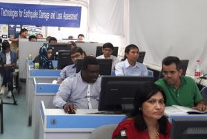
From 17 to 22 September 2015, UNOOSA/UN-SPIDER organised a training programme on ‘Earth observation technologies for earthquake damage assessment’ jointly with the  National Disaster Reduction Center of China (NDRCC), Asia Pacific Space Cooperation Organisation (APSCO) and Regional Centre for Space Science and Technology Education in Asia and the Pacific (China) (affiliated to the United Nations). This training was an extended event back to back with the United Nations International Conference on Space-based Technologies for Disaster Management…

more
Publishing date 21/09/2015

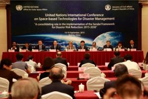
The United Nations International Conference on Space-based Technologies for Disaster Management - "A consolidating role in the implementation of the Sendai Framework for Disaster Risk Reduction: 2015-2030 “ was successfully conducted from 14 to 16 September 2015. The conference was co-organized by UN-SPIDER Beijing Office of the UN Office for Outer Space Affairs (UNOOSA) and the Ministry of Civil Affairs of the People’s Republic of China (PRC), in collaboration with the Department of Treaty and Law, Ministry of Foreign Affairs (MoFA) of PRC, the Department of System Engineering of China National Space Administration (…

more
Publishing date 21/09/2015

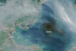
On the morning of August 13 the China Aerospace Science and Technology Corp activated its emergency response mechanism, after the fatal warehouse explosions that hit Tianjin port city. It used at least eight of its satellite constellation to monitor rescue and damage operatins thanks to their clear images.

Specifically, the Gaofen 1 and 2 high-resolution Earth observation satellites, the Ziyuan 3 Earth mapping satellite, the Shijian 9A technology test satellite, the Huanjing 1A low-resolution Earth observation satellite, the CBERS 4 remote sensing satellite, the Fengyun 2G and Fengyun 3B satellites were employed. Additionally, the National Satellite Meteorological Center also mobilized its weather satellites. They captured images in order to detect fires in the blast zones and sent them to government…

more
Publishing date 24/08/2015

The Northeast province of Jilin in China is planning to launch in October the country's first self-developed remote sensing satellite for commercial use.

Jilin-1 is composed of a group of four satellites: one in charge of high-definition imagery, one to test new space technologies and the other two to capture videos, as explained by Xuan Ming, board chairman of Chang Guang Satellite Technology, the company responsible for launching.

Beside their commercial aim, the pictures and videos provided by these four satellites will help forecasting and mitigating geological disasters as well as assisting the research of natural resources.

The project has been developed by the Changchun Institute of Optics, Fine Mechanics and Physics, of the Chinese Academy of Sciences.

more
Publishing date 05/08/2015

The China-Brazil Earth Resource Satellite-04 (CBERS-04), an Earth observation satellite jointly developed by both countries, was put into operation on Tuesday, July 13, after its launch on December 7. 

Developed by China's Academy of Space Technology and Brazil's National Institution of Space Research, the CBERS-04 can cover areas as big as China in 26 days and will be used to monitor geological disasters and estimate crops, among others. Its predecessor, the CBERS-03 was already launched from Taiyuan Satellite Launch Center on December 9, 2013, but did not reach the proper orbit.

African and Latin American countries will receive the data provided by the China-Brazil Earth Resource Satellite-04 without any charge. 

more
Publishing date 15/07/2015

China has signed an agreement with the European Union to enhance collaborative research in the field of remote sensing.

During the 17th bilateral summit between the European Union and the People's Republic of China that took place on Monday 29 June in Brussels, officials representing Europe’s Joint Research Centre (JRC) and the Chinese Academy of Sciences’ Institute of Remote Sensing arranged a deal to closely cooperate in the area of remote sensing.

“Under this new agreement, the co-operation will be reinforced and extended to promising areas, such as air quality, human settlement detection and characterisation, land and soil mapping, land cover mapping, digital earth sciences and agricultural monitoring,” JRC announced.

Among the collaborative activities included in this arrangement are the exchange of…

more
Publishing date 02/07/2015

China carried out on June 26 the unexpected launch of a new Earth Observation satellite called Gaofen-8 from the Taiyuan Satellite launch Center in Shanxi province. The launch was not announced beforehand by the authorities but is part of the China High-Resolution Earth Observation System (CHEOS), a series of high-resolution optical Earth Observation satellites placed in various orbits that will consist of eight or nine satellites.

This new space artifact was developed by China Aerospace Science and Technology Corporation (CASC) and according to Chinese officials, it is part of a civilian programme whose aim is to facilitate climate surveying, disaster response, precision agriculture mapping, urban planning and road network design. Its imagery will be mostly used by the Ministry of Land and Resources, the Ministry of Environmental Protection, and the Ministry of Agriculture.

During 2015 the Gaofen-3 launch is expected and Gaofen-4 will presumably be sent to space in…

more
Publishing date 01/07/2015

From 2 to 5 June 2015 UN-SPIDER, the National Disaster Reduction Centre of China (NDRCC), and UNESCAP jointly organized the four-day workshop of East Asia Summit (EAS) workshop on ‘Applications of Space Information Technology in Major Natural Disaster Monitoring and Assessment’ and 2nd ASEAN workshop on ‘Development of mechanisms for acquisition and utilisation of space-based information during emergency response. Nearly 50 government representatives and experts from 11 countries, 7 regional and international organizations and 14 research institutes attended the workshop to share experiences on applications of space-based information in major natural disaster monitoring and assessment. Both events took place in Hangzhou, China.

The EAS workshop included sessions on advance remote sensing technologies as well as the service of space based information for space-based disaster risk reduction. A special focus was placed on technology and applications using multi…

more
Publishing date 12/06/2015