• English
  • Español
  • Français

United
Nations


Office for Outer Space Affairs
UN-SPIDER Knowledge Portal

  • Home
  • About Us
    • What is UN-SPIDER?
    • About UNOOSA
    • Publications
    • Jobs
    • Meet the Team
    • Contact
  • Space Application
    • Satellite Technology
    • Emergency Mechanisms
    • Recovery Mechanisms
    • International Asteroid Warning Network
    • Space Mission Planning Advisory Group
    • International Space Weather Initiative
    • Space Technologies in the UN
    • User Stories
  • Links & Resources
    • Data Applications
      • Disaster Recovery
    • Data Sources
    • GIS and Remote Sensing Software
    • Online Learning Resources
    • Institutions
  • Risks & Disasters
    • Disaster Risk Management
    • Early Warning Systems
    • Emergency and Disaster Management
    • Natural Hazards
    • Sendai Framework
    • The UN and Disaster Risk Management
    • The UN and Early Warning
    • The UN and Disaster Management
  • Advisory Support
    • Advisory Missions
    • Emergency Support
    • Virtual Advisory Support
    • Recommended Practices
    • Training Activities
    • Practical Uses
  • Network
    • Regional Support Offices
    • GP-STAR
    • MHEWS
    • IWG-SEM
  • Projects
    • SPEAR
    • SEWS-D
    • EvIDENz
    • Flood GUIDE
  • News & Events
    • News
    • Events Calendar
    • UN-SPIDER Events Archive
  • Admin
    • SAM Items

Breadcrumb

  • Home
  • Links and Resources
  • Data Sources
  • Data Sources

Data Sources

Photo by Donald Giannatti on Unsplash.

This database provides descriptions of a large variety of satellite imagery, elevation models, land use and land cover maps as well as near real-time data products for different hazard types. You can search the database by data type or hazard as well as by other relevant factors including costs, temporal or spatial coverage, satellite or file types.

When you select a specific country under "spatial coverage", please note that the system will retrieve datasets that are exclusively carrying information for that specific country (and no other country). This means that global datasets, which include information for a particular country of interest as well as for other countries, will not be displayed. As a result, it is recommended to start with a global search.

The results of each search are connected to other items on the UN-SPIDER Knowledge Portal, such as the database of GIS and remote sensing software and the descriptions of natural hazards.

To support Member States in identifying and accessing relevant space-based information, UN-SPIDER also creates booklets that provide an overview of data sources listed on these pages and of particular interest to the countries it is providing technical advisory support to. The following booklets are available:

- Tunisia

- Ethiopia

- Cameroon

Active Fire Data MODIS FIRMS (NASA)
Type:
hazard specific data
Costs:
free
Hazard:
Forest Fire
Format:
export data, export map, visualization of data (e.g. web GIS or real time monitoring)
Publisher:
National Aeronautics and Space Administration (NASA)
Actual Evapotranspiration Anomaly and NDVI (FEWS NET - USGS, USAID)
Type:
baseline data, hazard specific data, land use, land cover data
Costs:
free
Hazard:
Drought
Format:
export data, visualization of data (e.g. web GIS or real time monitoring)
Publisher:
United States Geological Survey (USGS)
Advanced Microwave Scanning Radiometer 2 (AMSR2 - NASA)
Type:
baseline data
Costs:
free
Hazard:
Format:
visualization of data (e.g. web GIS or real time monitoring)
Publisher:
National Aeronautics and Space Administration (NASA)
Screenshot of ASTER
Advanced Spaceborne Thermal Emission and Reflection Radiometer (ASTER Data Archive - NASA)
Type:
satellite data or aerial image
Costs:
free
Hazard:
Drought, Severe Storm, Extreme Temperature
Format:
export data, export map, statistical data (e.g. graphs)
Publisher:
National Aeronautics and Space Administration (NASA)
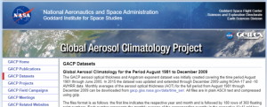
Screenshot of the Global Aerosol Climatology Project website.
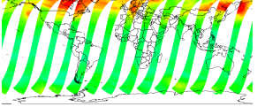
Aerosol Profile (NASA)
Type:
hazard specific data
Costs:
free
Hazard:
Volcanic Eruption, Pollution
Format:
export data
Publisher:
National Aeronautics and Space Administration (NASA)
Aerosol Profile (WDC-RSAT - DLR)
Type:
Costs:
free
Hazard:
Volcanic Eruption, Pollution
Format:
export data, export map, statistical data (e.g. graphs), visualization of data (e.g. web GIS or real time monitoring)
Publisher:
World Data Center for Remote Sensing of the Atmosphere (WDC-RSAT)
Africa Data Portal (FEWS NET - USGS, USAID)
Type:
hazard specific data
Costs:
free
Hazard:
Drought, Flood, Forest Fire, Mass Movement
Format:
export data, visualization of data (e.g. web GIS or real time monitoring)
Publisher:
United States Geological Survey (USGS)
Africa GeoPortal (esri)
Type:
hazard specific data, land use, land cover data
Costs:
free with restrictions
Hazard:
Epidemic, Insect Infestation, Climatological
Format:
export data, export map, visualization of data (e.g. web GIS or real time monitoring)
Publisher:
Africa High Resolution Population Density Maps (CIESIN)
Type:
baseline data, land use, land cover data
Costs:
free
Hazard:
Format:
export data, export map
Publisher:
Center for International Earth Science Information Network (CIESIN) - Columbia University
African Flood and Drought Monitor (AFDM)
Type:
hazard specific data
Costs:
free
Hazard:
Drought, Flood
Format:
export map, statistical data (e.g. graphs)
Publisher:
Princeton University
African Flood and Drought Monitor (AFDM)
Type:
hazard specific data
Costs:
free
Hazard:
Drought, Flood
Format:
export map, statistical data (e.g. graphs)
Publisher:
Princeton University
Agricultural Stress Index System (ASIS - FAO)
Type:
hazard specific data
Costs:
free
Hazard:
Forest Fire, Drought, Flood
Format:
statistical data (e.g. graphs), visualization of data (e.g. web GIS or real time monitoring)
Publisher:
Food and Agriculture Organization of the United Nations (FAO)
Agricultural Stress Index System (ASIS - FAO)
Type:
hazard specific data
Costs:
free
Hazard:
Forest Fire, Drought, Flood
Format:
statistical data (e.g. graphs), visualization of data (e.g. web GIS or real time monitoring)
Publisher:
Food and Agriculture Organization of the United Nations (FAO)
Agricultural Stress Index System (ASIS - FAO)
Type:
hazard specific data
Costs:
free
Hazard:
Forest Fire, Drought, Flood
Format:
statistical data (e.g. graphs), visualization of data (e.g. web GIS or real time monitoring)
Publisher:
Food and Agriculture Organization of the United Nations (FAO)
Screenshot of Agrometeorological Data in SPIRITS format (JRC-IES)
Agrometeorological Data in SPIRITS format (JRC-IES)
Type:
hazard specific data
Costs:
free
Hazard:
Drought, Flood, Extreme Temperature
Format:
export data
Publisher:
Joint Research Centre (JRC)
Map
AIRBUS data set
Type:
elevation, satellite data or aerial image
Costs:
paid
Hazard:
Forest Fire, Insect Infestation, Severe Storm, Volcanic Eruption, Earthquake, Epidemic, Extreme Temperature, Flood, Drought, Harmful Algal Bloom, Mass Movement, Tsunami, Pollution
Format:
export data
Publisher:
Airbus Defence & Space
Map
AIRBUS data set
Type:
elevation, satellite data or aerial image
Costs:
paid
Hazard:
Forest Fire, Insect Infestation, Severe Storm, Volcanic Eruption, Earthquake, Epidemic, Extreme Temperature, Flood, Drought, Harmful Algal Bloom, Mass Movement, Tsunami, Pollution
Format:
export data
Publisher:
Airbus Defence & Space
Map
AIRBUS data set
Type:
elevation, satellite data or aerial image
Costs:
paid
Hazard:
Forest Fire, Insect Infestation, Severe Storm, Volcanic Eruption, Earthquake, Epidemic, Extreme Temperature, Flood, Drought, Harmful Algal Bloom, Mass Movement, Tsunami, Pollution
Format:
export data
Publisher:
Airbus Defence & Space

Pagination

  • Current page 1
  • Page 2
  • Page 3
  • Page 4
  • Page 5
  • Page 6
  • Page 7
  • Page 8
  • Page 9
  • …
  • Next page Next ›
  • Last page Last »


Footer menu

  • Contact
  • Terms of Use

User account menu

  • Log in