Disaster response efforts benefit substantially from the use of information on the geographical extent of the hazard that triggered the disaster. For example, maps of the geographical extent of floods allow disaster managers to become aware of all the communities and assets that may have been affected. Such maps allow disaster managers to estimate the number of people that may seek temporary shelter in safe areas, to identify crops and critical infrastructure that may have been affected, roads that can still be used to deliver humanitarian assistance to affected areas, and the identification of other roads which can no longer be used because they are flooded.
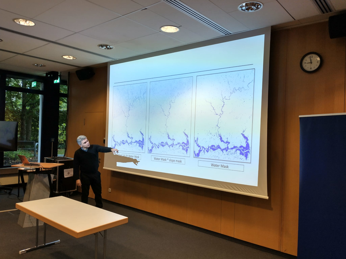
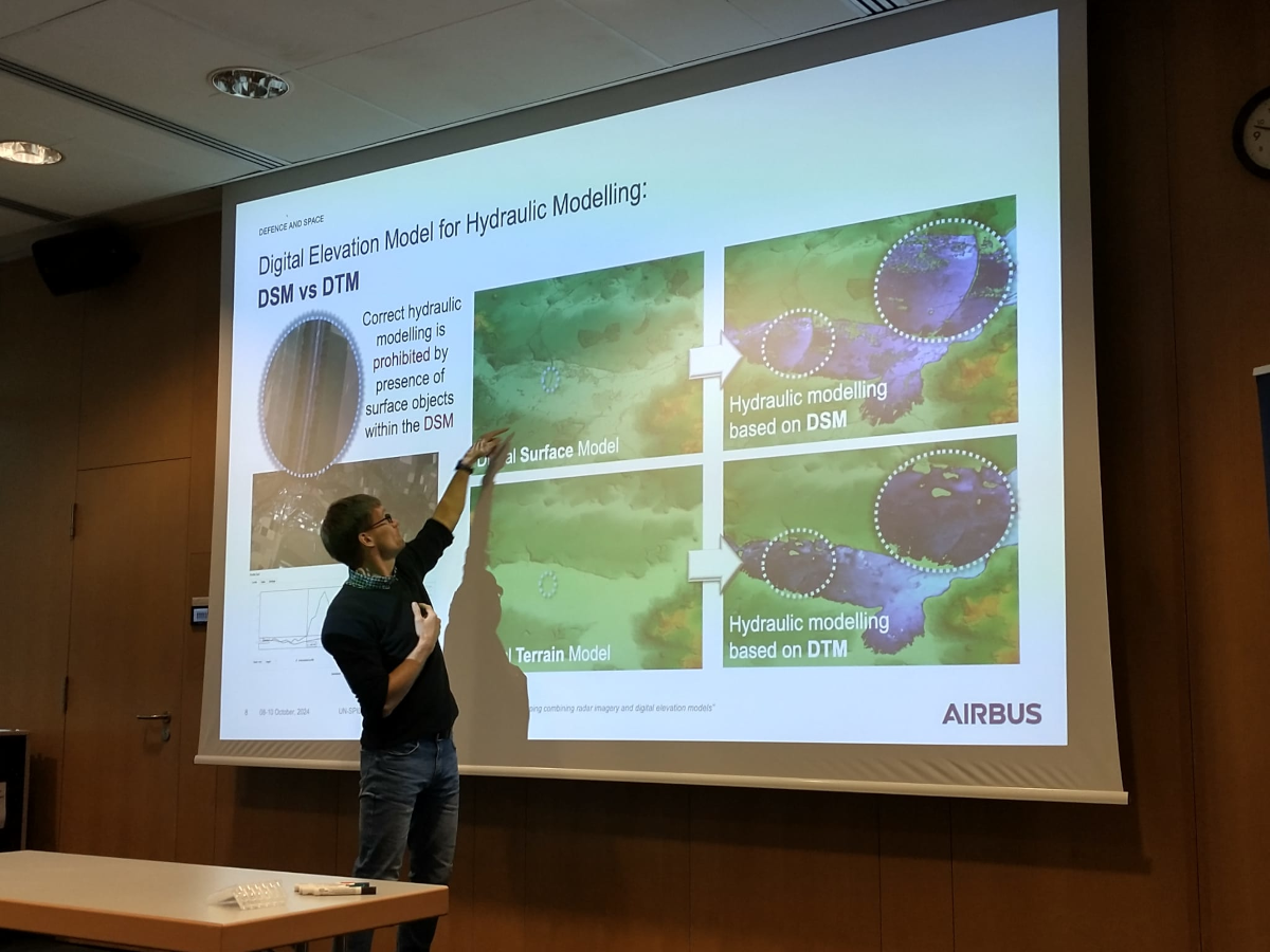
Satellite imagery has been, for the past three decades, the key source of geospatial data to generate such maps of affected areas. With the advent of radar imagery, flooded areas could be identified even under cloudy conditions. However, unwanted reflections of radar signals from buildings and vegetation in flooded areas do not allow for a precise identification of all flooded areas. To address this challenge, digital terrain models can be used to assess the likelihood that areas next to such buildings or vegetated areas may be flooded.
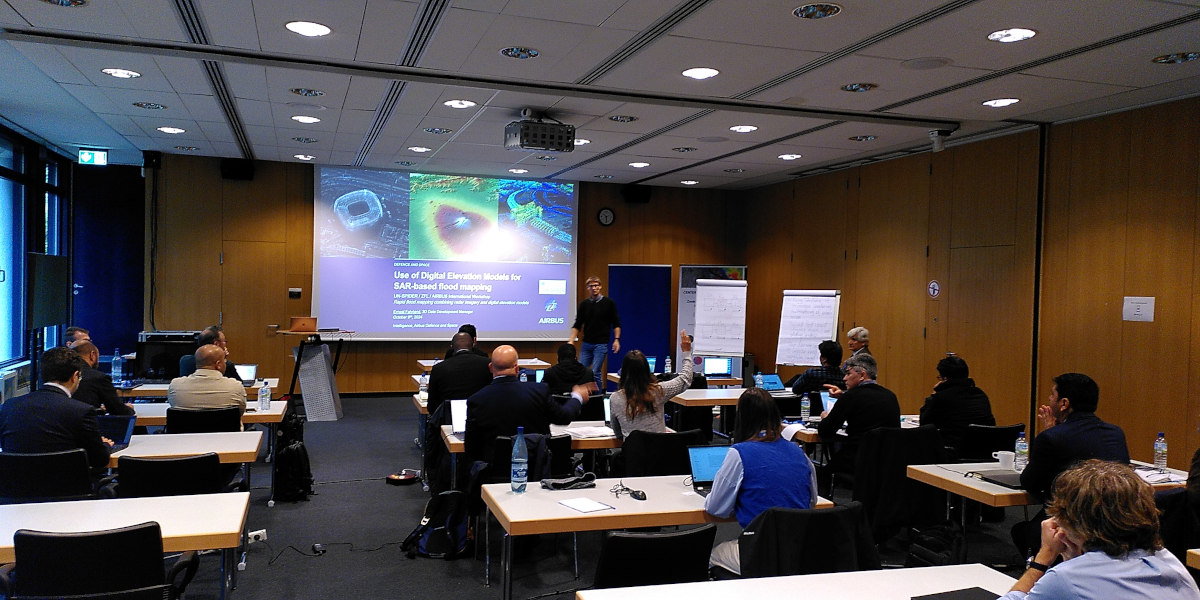
Between 8 and 10 October 2024, UN-SPIDER together with Airbus Defense and Space and the ZFL of the University of Bonn organized a technical workshop to discuss ways to combine these two sources of geospatial data to improve flood mapping procedures, including the UN-SPIDER flood mapping Recommended Practices. Experts from Airbus Defense and Space, the Joint Research Centre of the European Commission (EC-JRC), the Luxembourg Institute of Science and Technology (LIST), the Federal University of Santa Maria in Brazil, the German Federal Institute of Hydrology (BfG); and experts from space agencies of Algeria, Nigeria, South Africa; and other government agencies from Chile, Colombia, Germany, and Morocco; and researchers from Germany and the United Kingdom discussed ways to use digital terrain models to remove unwanted signals detected with radar imagery and to discuss ways in which different parameters extracted from digital terrain models can be used to assess the likelihood that selected pixels in radar imagery may be flooded.
The workshop served as a starting point for a project in which the experts will continue to work together to develop a set of recommendations on ways in which digital terrain models can be used to improve the detection of potentially flooded areas. Such recommendations will then be used to improve the UN-SPIDER Recommended Practices and eventually develop new practices and tools, which will then be shared via the UN-SPIDER Knowledge Portal.