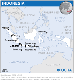
The Indonesian National Institute of Aeronautics and Space (LAPAN) previously hosted the Indonesia UN-SPIDER Regional Support Office (RSO). This organization has merged with other Indonesian research agencies under the National Research and Innovation Agency (BRIN) since September 2021.
The RSO-Indonesia was established on 19 February 2013 during the fiftieth session of the Scientific and Technical Subcommittee of the Committee on the Peaceful Uses of Outer Space in Vienna, Austria. Since then, various projects have been implemented in the field of disaster management and emergency response, such as floods, droughts, fire hotspots, and climate monitoring or prediction, as well as the assessment of tsunamis, earthquakes, and volcanic eruptions. As an RSO-Indonesia, BRIN will continue to provide experts for UN-SPIDER's Technical Advisory Support to countries within the region and contribute to capacity building efforts in the region.
- Fundamental of Remote Sensing and Digital Image Processing.
- Remote sensing applications for environmental (forest degradation, oil spill, water pollution, illegal mining, land subsidence, slum areas, etc) and disaster (drought, flood, landslide, forest fire, volcanic eruption, tsunami).
- Advanced Remote Sensing (SAR processing and analysis).
Under BRIN, RSO-Indonesia has been coordinated by the Indonesian Space Agency Secretariat (INASA) in collaboration with other units namely the Data and Information Center and the Research Center for Remote Sensing. More than 100 scientists and engineers are responsible for conducting all phases of remote sensing operations, including data acquisition, data processing and management, and data analysis including GIS analysis. Team members are highly experienced in various remote sensing applications, such as disaster mitigation, vulnerability and risk assessment for disaster, climate change modeling, environmental monitoring or natural resources monitoring.
Remote Sensing Ground Stations in Pare-Pare (South Sulawesi) and Jakarta have received Landsat-7, Terra/Aqua MODIS, SPOT-2/4, NOAA, and FengYun-1D. Since 2013, LAPAN has upgraded the ground station system to receive NPP/NPOES, FengYun-3B/C, Landsat-8/9, SPOT-5/6/7, Pleiades, and SAR data. BRIN also has Unmanned Aerial Vehicle (UAV) technology for airborne Remote Sensing, which can be used to monitor the disaster areas to support the reconstruction and rehabilitation activities. Remote sensing and GIS tools are used to process the data.
BRIN was initially a unit with the Ministry of Research and Technology (Kemenristek), however as it developed, on 5 May 2021, President Joko Widodo signed Presidential Regulation No. 33 of 2021, which effectively stipulates BRIN as the only national research body. This regulation stipulates that all Indonesian national research bodies such as the Indonesian Institute of Sciences (LIPI), the Agency for the Assessment and Application of Technology (BPPT), the National Nuclear Energy Agency (BATAN), and the National Institute of Aeronautics and Space (LAPAN) were merged into BRIN. BRIN's position is still as a regulator in space activities. Since then BRIN has become a separate agency following the merger of BATAN, BPPT, LAPAN and LIPI as well as research institutions within ministries and institutions. In order to support disaster information using Remote Sensing satellite data, BRIN coordinates with the Indonesian National Disaster Management Authority (BNPB or NDMA).

