- More than 100 engineers and scientists
- More than 150 support staff
Space Assets
SUPARCO has 2x communication satellites i.e. PakSat-1R (2011) and PakSat MM-1 (2024) and 4x remote sensing satellite i.e. PRSS-1 and PAKTES-1A (2018), EO-1 (2025), EO-2 (2025).
Infrastructure
Latest state of the art hardware & software available with high speed internet connectivity on 24/7 hours basis.
Facilities
- Space Application Centre for Response in Emergency and Disasters (SACRED)
- National Centre for Remote Sensing & Geo-Informatics
- Atmospheric Data Receiving and Processing Centre
- COSPAS-SARSAT (Ground segment)
- National Centre for Agriculture Information (NAIC)
- Space Tech Application Directorate
- Spatial Planning and Governance Application Directorate
Space Application Centre for Response in Emergency and Disasters (SACRED)
SUPARCO established dedicated a “Space Application Centre for Response in Emergency and Disasters” in 2014 with aim to provide space based support to National/Provincial Disaster Managements (N/PDMAs) in the event of national disasters. SACRED has state of art facilities and specialized human resource. SACRED is the focal point for national and international organizations including UN-SPIDER, International Charter Space and Major Disasters, Sentinel Asia and APSCO.
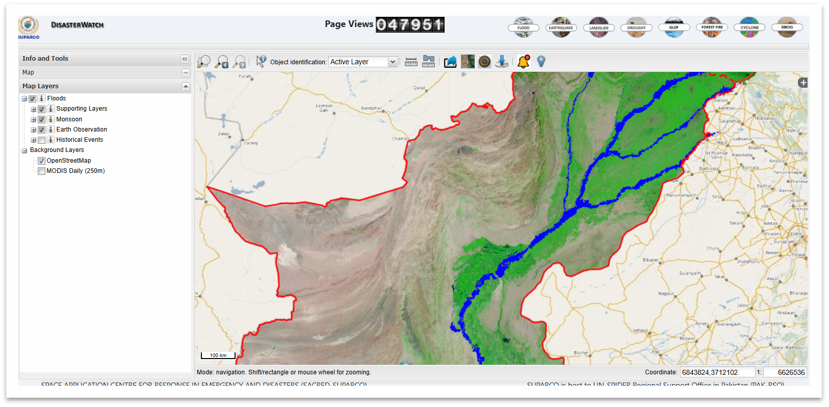
DisasterWatch
SUPARCO developed Web GIS portal namely DisasterWatch for near real time dissemination of Space based information in the events of natural disasters. Disaster Watch can be accessed at http://disasterwatch.sgs-suparco.gov.pk . DisasterWatch provides space based information regarding developing disaster situation, rapid damage assessment, reconstruction and rehabilitation activities. DisasterWatch currently provides information related to flood, drought, landslide, GLOF, heatwave, forest fire, SMOG/FOG, earthquake disasters.
Training/courses Offered
SUPARCO offers specialized training courses for different sectors. Some of the courses are:
- Space based disaster management – Shifting from Reactive to Proactive Approach
- Hands-on training on the Integrated Search and Rescue space based system - COSPAS-SARSAT
- Advanced Applications of Water Resource Management using Satellite Remote Sensing
- Remote Sensing for the Environment and Modeling Air Quality and Climate Change
- Advanced Applications of Forestry in Remote Sensing & GIS
- Remote Sensing & GIS Applications in Geology
- Advanced Training Course on SRS & GIS
- RS & GIS application in natural resource management
- Programming for Web GIS Development using Open Source Technologies
- Introduction to Machine Learning in Remote Sensing
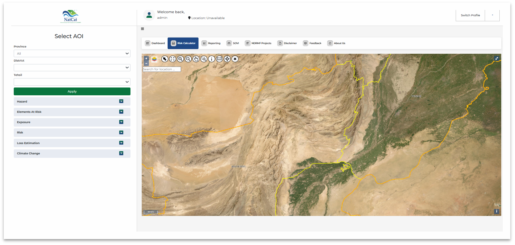
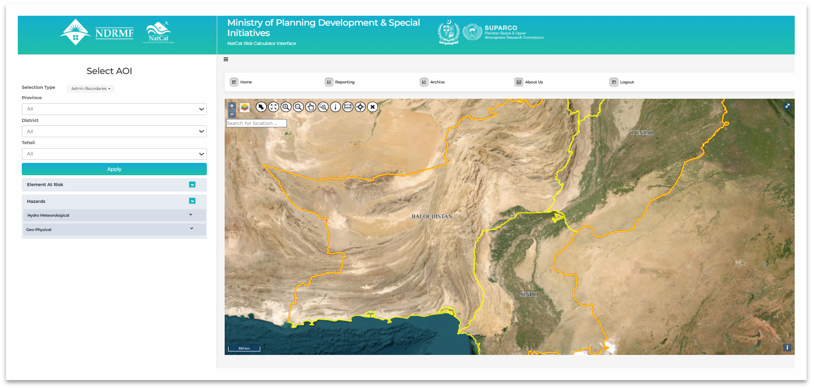
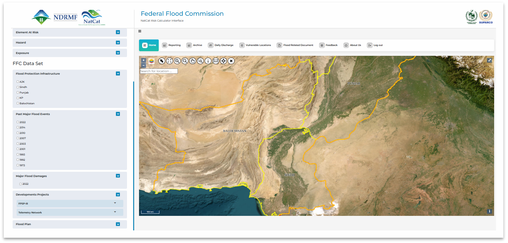
Natural Catastrophe Modeling
SACRED-SUPARCO developed the Natural Catastrophe Model (NatCat) for National Disaster Risk Management Fund (NDRMF). NatCat assesses probabilistic Hazards, exposure, vulnerability and Risk/Loss assessment against 9x perils i.e. flood, urban flood, flash flood (Nari basin), drought, heatwave, cyclone, earthquake, tsunami, landslide. NatCat model outcomes include NatCat Risk Calculator, Spatial Planning Interface for Ministry of Planning Development and Special Initiatives (MoPD&SI) and DRR Interface for Federal Flood Commission (FFC).