• English
  • Español
  • Français

United
Nations


Office for Outer Space Affairs
UN-SPIDER Knowledge Portal

  • Accueil
  • À propos
    • Qu'est-ce que l'ONU-SPIDER?
    • À propos d’UNOOSA
    • Publications
    • Offres d'emploi
    • Rencontrez l'équipe
    • Contact
  • Applications spatiales
    • Technologie satellitaire
    • Mécanismes d’urgence
    • Recovery Mechanisms
    • Réseau international d'alerte aux astéroïdes
    • Space Mission Planning Advisory Group
    • Initiative internationale sur la météorologie spatiale
    • Les technologies spatiales à l'ONU
    • Comptes-rendus d'utilisateurs
  • Liens & ressources
    • Application de données du mois
      • Disaster Recovery
    • Sources de données
    • SIG et logiciels de télédétection
    • Online Learning Resources
    • Institutions
  • Risques & catastrophes
    • Prévention des risques de catastrophe
    • Systèmes d'alerte précoce
    • Gestion des catastrophes et des interventions d'urgence
    • Aléas naturels
    • Cadre d'action de Sendai
    • L'ONU et la prévention des risques de catastrophe
    • L'ONU et les alertes précoces
    • L'ONU et la gestion des catastrophes
  • Appui technique
    • Missions Conseil
    • Appui d’urgence
    • Appui à distance
    • Pratiques recommandées
    • Activités de formation
    • Utilisations pratiques
  • Réseaux
    • Bureaux régionaux d’appui
    • GP-STAR
    • MHEWS
    • IWG-SEM
  • Projets
    • SPEAR
    • SEWS-D
    • EvIDENz
    • Flood GUIDE
  • Actualités
    • Actualités
    • Événements
    • Événements passés
  • Admin
    • SAM Items

Breadcrumb

  • Home
  • Flood Early Warning And Early Action System (FEWEAS) Mobile App Helps Predict Flooding
  • Flood Early Warning and Early Action System (FEWEAS) mobile app helps predict flooding

Flood Early Warning and Early Action System (FEWEAS) mobile app helps predict flooding

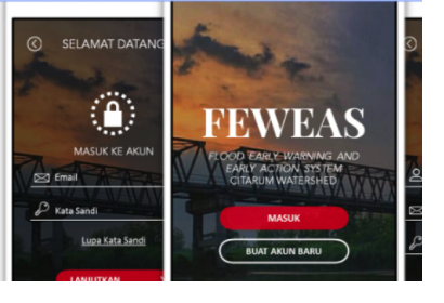
Flood Early Warning and Early Action System (FEWEAS) Citraum app. Image: FEWEAS Citraum.

A new mobile phone application provides early warning and early action information related to the Citarum River Basin in Indonesia. FEWEAS Citarum can be downloaded for free on Android and iOS phones and is expected to help the authorities with the mitigation and disaster risk reduction around the area of the Citarum River Basin in Indonesia. The app is an initiative of the Bandung Institute of Technology (ITB) research team in collaboration with the International Federation of Red Cross and Red Crescent Societies (IFRC), the Indonesian Red Cross (PMI) and Zurich Insurance Indonesia (ZII).

Indonesia is known as one of the countries that is more prone to flooding disasters primarily due to factors such as the country’s topographic condition and geographical location, prolonged and intense rainfall, and human activities. In particular, the Citarum River Basin in Indonesia has been affected by environmental damage such as deforestation and drains blocked by waste. As a result of these and other factors, cities such as Bandung suffer from regular flooding.

The FEWEAS Citarum app was launched on 11 December as a solution to reduce risks and increase community resilience to floods in the Citarum River Basin. The app generates flood warnings from a combination of data on topographic conditions, weather, soil types, and spatial planning. The data is collected through the National Disaster Mitigation Agency [BNPB] from stakeholders, ministries and institutions, including the National Oceanic and Atmospheric Administration (NOAA).The app claims to be able to predict the location, time, and height of the flood with up to 90% accuracy. The results can be utilized for long-term prediction of floods as well as for the anticipation of drought.
FEWEAS Citarum website
Thu, 14 Dec 2017 - 11:32
Indonesia

Footer menu

  • Contact
  • Terms of Use

User account menu

  • Log in