The training date is in the past. However, videos and resources of the training can be accessed here.
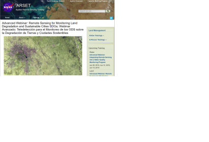
The Sustainable Development Goals (SDGs) are an urgent call for action by countries to preserve our oceans and forests, reduce inequality, and spur economic growth. The land management SDGs call for consistent tracking of land cover metrics. These metrics include productivity, land cover, soil carbon, urban expansion, and more. This webinar series will highlight a tool that uses NASA Earth Observations to track land degradation and urban development that meet the appropriate SDG targets.
SDGs 11 and 15 relate to sustainable urbanization and land use and cover change. SDG 11 aims to "make cities and human settlements inclusive, safe, resilient, and sustainable." SDG 15 aims to "combat desertification, drought, and floods, and strive to achieve a land degradation neutral world." To assess progress towards these goals, indicators have been established, many of which can be monitored using remote sensing.
In this training, attendees will learn to use a freely-available QGIS plugin, Trends.Earth, created by Conservation International (CI). Trends.Earth allows users to plot time series of key land change indicators. Attendees will learn to produce maps and figures to support monitoring and reporting on land degradation, improvement, and urbanization for SDG indicators 15.3.1 and 11.3.1. Each part of the webinar series will feature a presentation, hands-on exercise, and time for the speaker to answer live questions.
Learning Objectives:
By the end of this training, attendees will:
Become familiar with SDG Indicators 15.3.1 and 11.3.1
Understand the basics on how to compute sub indicators of SDG 15.3.1 such as: productivity, land cover, and soil carbon
Understand how to use the Trends.Earth Urban Mapper web interface
Learn the basics of the Trends.Earth toolkit including:
Plotting time series
Downloading data
Use default or custom data for productivity, land cover, and soil organic carbon
Calculate a SDG 15.3.1 spatial layers and summary table
Calculate urban change metrics
Create urban change summary tables
Course Format:
Three, 1.5-hour sessions that include lectures, hands-on exercises, and a question and answer session
The first session will be broadcast in English, and the second session will contain the same content, broadcast in Spanish
Download and install the Trends.Earth software. This is a QGIS plugin that only currently works with the Version 2 iterations of QGIS (not version 3 or higher).
This training will be appropriate for local, regional, state, federal, and international organizations interested in generating data used for SDG reporting with satellite imagery. Professional organizations in the public and private sectors engaged in environmental management and monitoring will be given preference over organizations focused primarily on research.