Egyptian Society for Environmental Change
Matrouh University
Delta State University
UN-SPIDER
The future of Earth is at stake as the world grapples with a climate changing at rates unprecedented in human times. Climate change is fueling a growing gulf of economic and social inequity, shrinking the scope of biodiversity, turning fallow the agricultural lands needed to feed humanity, and eating away at our common heritage through the destruction of world heritage sites. These challenges manifest as massively disruptive forces in the lives of individuals and communities which, through a multitude of mechanisms ranging from dysfunctional governance to unhealthy industrial practices, feed back into anthropogenic induced climate change and concomitant causes of disaster. Arid regions are particularly susceptible to climate change due to a natural scarcity and fragility of resources which are already combining to drive social unrest caused by hunger, forced human migration, and related economic misfortune.
Droughts are a recalcitrant problem in arid regions and are characterized by deep, widespread, and underestimated impacts on societies, ecosystems, and economies. Drought is among the most persistent and severe disaster hazards faced because they are difficult to forecast, not well understood and their cost to society and ecosystems substantially underestimated. Addressing these concerns through collaborative stakeholder-, historic-, systemic-, and consequence-based approaches is of paramount importance to meeting agreed upon goals established by the global community via the Sendai Framework for Disaster Risk Reduction, the Paris Agreement, and United Nations Sustainable Development Goals. Data-driven approaches which provide convincing evidence for the creation of mitigation plans and policy are essential to combating drought and, in general, climate change.
Management of natural disasters, and drought particularly, follow a continuous approach of planning, mitigation, response, and recovery - each of which benefits considerably from space-based and geospatial assets. These benefits include the Earth observation systems needed for weather and climate modeling and forecasting, communications, location and location-based services, and the information required of a common operating picture for a uniquely broad audience of stakeholders spanning from individuals to international organizations. The uniqueness in serving such a wide range of stakeholders and their connection to both the disaster management cycle and the global policy objectives warrants increased capacity building efforts. A comprehensive and collaborative approach rooted in space-based technologies provides a science-based path forward for meeting the 2030 agenda for sustainable development and subsidiary initiatives as the world recovers and learns from the COVID-19 pandemic.
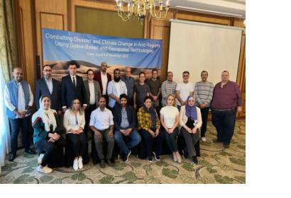
This workshop will provide training in the capture, processing, analysis, and use of space-based data for use in combating the effects of climate-change driven disasters in arid regions. Special emphasis will be placed upon spatial-temporal analysis methods which aid in the processing of freely available satellite data products and services to understand and mitigate against the effects of climate-induced disasters. The overarching objective is for participating scientists, engineers, and technologists to use the techniques presented to support decision makers in the creation of science-based plans and policy at regional and national levels.
