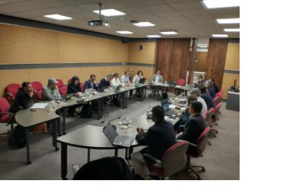
As in the case of other regions of the world, Latin America is exposed to various types of geological and hydro-meteorological hazards which trigger disasters. To contribute to strengthen the skills of professionals that contribute to disaster response efforts through the generation of space-based information, UN-SPIDER, ECLAC and the International Charter Space and Major Disasters organised the training course "Project Management using the ESA Charter Mapper". The training course brought together 15 professionals with skills in project management in case of activations of the International Charter from Argentina, Bolivia, Brazil, Chile, Colombia, Costa Rica, Ecuador, Mexico, Paraguay and Peru. The training course was held in the premises of ECLAC in Santiago de Chile from 7 to 9 November 2023 and its aims have been:
- To introduce participants to the novel "ESA Charter Mapper" tool implemented by the International Charter.
- To strengthen the skills of participants in the processing of satellite imagery to map the geographical extent of areas affected by floods, earthquakes, landslides and forest fires.
- To contribute to enhance the use of space technologies to contribute to disaster response efforts.
Participants also took note of the efforts implemented by ECLAC to promote the use of geospatial information at national level through the implementation of global guidelines elaborated by disseminated by the United Nations Committee of Experts on Global Geospatial Information Management (UN GGIM), specifically those where geospatial information contributes to disaster and emergency management,
Participants also became aware of relevant aspects of the Damage and Loss Assessment methodology (DALAs) developed by ECLAC; and regarding other activities implemented by ECLAC regarding the management of statistical data related to climate change and disasters.

