Overview of the Disaster and Objectives
Disaster Overview
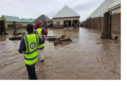
On 28 July 2025, torrential rainfall in Adamawa State, Nigeria caused devastating flooding across Yola North and Yola South. At least 23 people lost their lives, many others were injured or remain missing, and hundreds of families were displaced. Entire communities, including Shagari Low Cost, Sabon Pegi, and Modire Yolde Pate, were severely affected as floodwaters swept through homes and infrastructure.
While heavy rainfall was the immediate trigger, the disaster was compounded by blocked water channels and unregulated construction, which hindered natural drainage. The scale of this tragedy underscored both the vulnerability of urban systems and the urgent need to monitor critical hydraulic infrastructure in the region.
Concerns focused particularly on Kiri Dam in Adamawa State and Dadin Kowa Dam in neighboring Gombe State. The Nigerian government had already expressed alarm in late 2024 over the structural safety of Dadin Kowa Dam, warning of potential collapse risks. In the wake of the July 2025 floods, the risk of cascading disasters linked to dam instability became a priority for humanitarian agencies.
Objectives of this Web Report
This report documents UN-SPIDER’s response to UNOCHA’s request for continuous satellite-based monitoring of Kiri and Dadin Kowa Dams following the Nigeria floods. It highlights the role of satellite constellations in disaster risk reduction, the contributions of commercial space partners, and the importance of integrating these data streams into national and international humanitarian decision-making.
Implementation of Satellite Image Acquisition and Analysis
UN-SPIDER's Role in Facilitating Access to Satellite Imagery
UN-SPIDER serves as a bridge between the disaster management community and the space sector, ensuring that humanitarian actors can access timely satellite information. In response to UNOCHA’s request, UN-SPIDER mobilized its partnerships with commercial satellite providers to secure radar imagery on a near-daily basis.
Provide Satellite Image from Space Startups
Through partnerships, two commercial satellite operators — Spacety and Synspective — played a central role in the monitoring campaign:
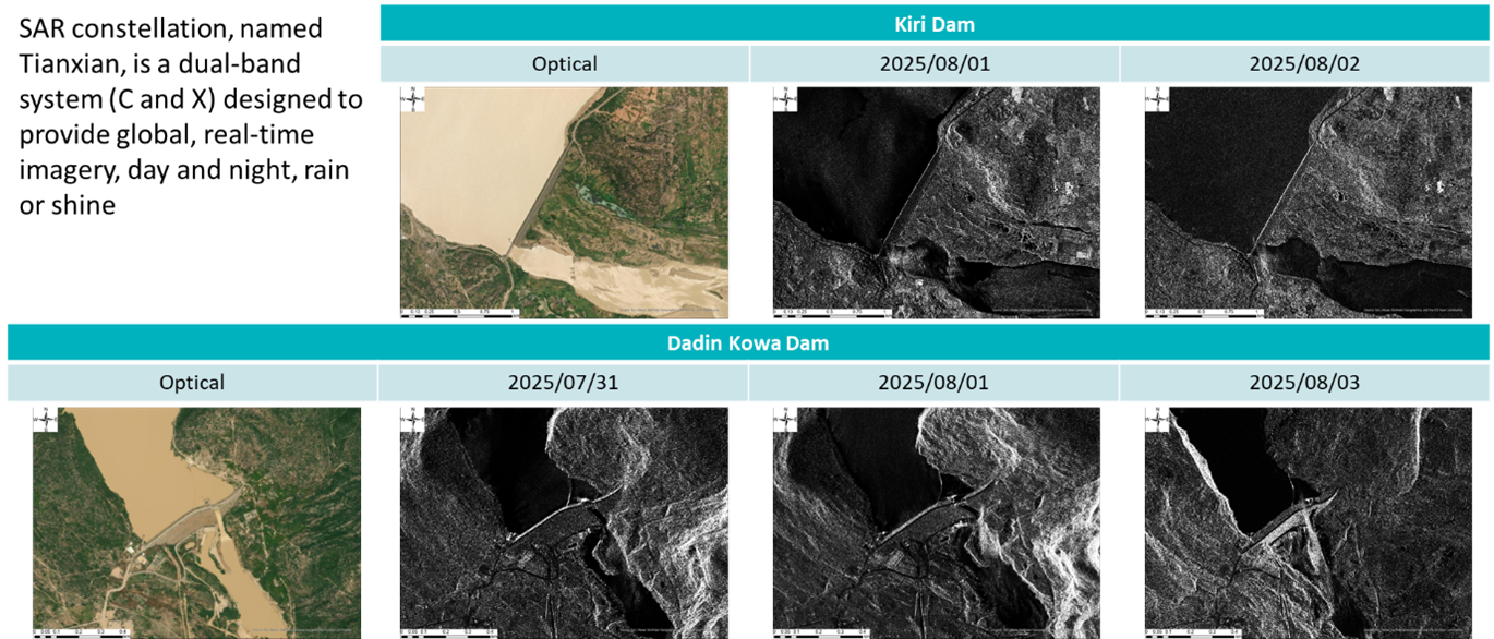
• Spacety’s Tianxian SAR constellation, a dual-band (C and X) system, was tasked to monitor both Kiri and Dadin Kowa Dams between 31 July and 3 August 2025. Its all-weather, day-and-night imagery provided detailed insights into reservoir conditions, embankments, and spillway structures.
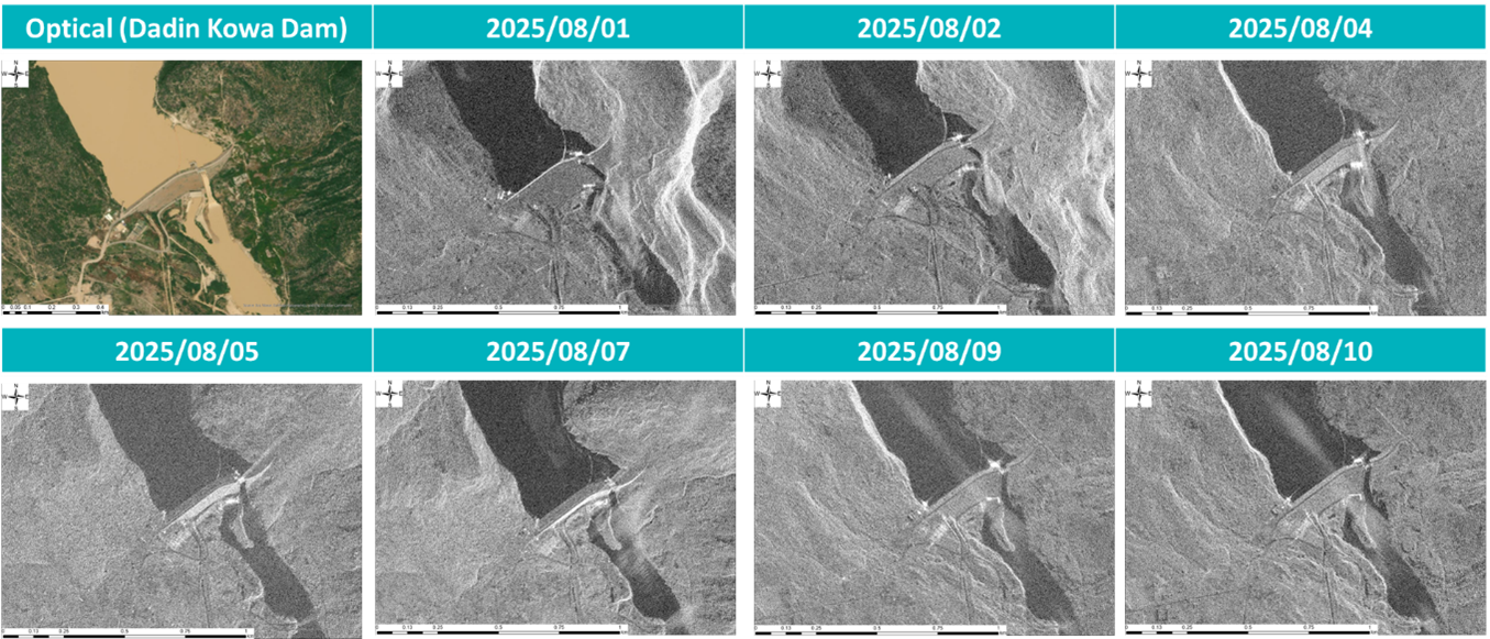
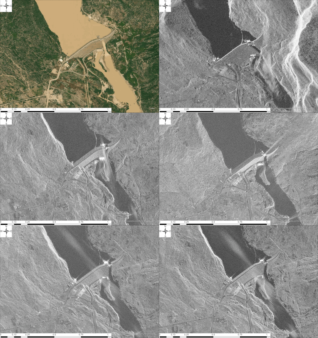
• Synspective’s StriX SAR constellation conducted daily monitoring of Dadin Kowa Dam from 1 to 10 August 2025, capturing high-resolution temporal changes in the dam embankments, water storage, and surrounding terrain.
Kiri Dam & Dadin Kowa Dam daily SAR imagery
The coordinated monitoring effort produced a sequence of high-resolution imagery that revealed short-term hydrological and structural dynamics at the two dams.
• Figure 2 illustrates Spacety’s Tianxian SAR constellation tasking of both dams between 31 July and 3 August 2025.
• Figure 3 presents Synspective’s StriX SAR constellation monitoring of Dadin Kowa Dam from 1 to 10 August 2025.
These datasets enabled responders to detect potential risks, such as unusual water discharge, embankment stress, erosion, or seepage, even under persistent cloud cover during the rainy season.


Potential of Satellite Constellations in Disaster Response and UN-SPIDER's Role
Satellite constellations offer frequent, reliable, and scalable monitoring capabilities essential for modern disaster response. Their combined use of optical and synthetic aperture radar (SAR) sensors ensures that observation continues day and night, through cloud and rain, and across vast geographical areas.
For humanitarian operations, such constellations allow:
- Rapid detection of damage to critical infrastructure.
- Continuous assessment of hydrological risks, including dam safety.
- Improved planning for evacuations and water management decisions.
UN-SPIDER’s role is to translate these technical capacities into actionable insights, connecting humanitarian actors such as UNOCHA and national disaster agencies with satellite operators and data products. By facilitating this monitoring campaign, UN-SPIDER reaffirmed its mandate to ensure that space-based information directly supports humanitarian needs.
Main Image Reference: BBC News Pidgin (2025). 23 die for Adamawa flood – How goment fit reduce di impact of flood for Nigeria? Retrieved from https://www.bbc.com/pidgin/articles/c62nr3gvkmlo

