  • English
  • Español
  • Français

United
Nations


Office for Outer Space Affairs
UN-SPIDER Knowledge Portal

  • Accueil
  • À propos
    • Qu'est-ce que l'ONU-SPIDER?
    • À propos d’UNOOSA
    • Publications
    • Offres d'emploi
    • Rencontrez l'équipe
    • Contact
  • Applications spatiales
    • Technologie satellitaire
    • Mécanismes d’urgence
    • Recovery Mechanisms
    • Réseau international d'alerte aux astéroïdes
    • Space Mission Planning Advisory Group
    • Initiative internationale sur la météorologie spatiale
    • Les technologies spatiales à l'ONU
    • Comptes-rendus d'utilisateurs
  • Liens & ressources
    • Application de données du mois
      • Disaster Recovery
    • Sources de données
    • SIG et logiciels de télédétection
    • Online Learning Resources
    • Institutions
  • Risques & catastrophes
    • Prévention des risques de catastrophe
    • Systèmes d'alerte précoce
    • Gestion des catastrophes et des interventions d'urgence
    • Aléas naturels
    • Cadre d'action de Sendai
    • L'ONU et la prévention des risques de catastrophe
    • L'ONU et les alertes précoces
    • L'ONU et la gestion des catastrophes
  • Appui technique
    • Missions Conseil
    • Appui d’urgence
    • Appui à distance
    • Pratiques recommandées
    • Activités de formation
    • Utilisations pratiques
  • Réseaux
    • Bureaux régionaux d’appui
    • GP-STAR
    • MHEWS
    • IWG-SEM
  • Projets
    • SPEAR
    • SEWS-D
    • EvIDENz
    • Flood GUIDE
    • CommonSpace Initiative
  • Actualités
    • Actualités
    • Événements
    • Événements passés

Breadcrumb

  • Home
  • SPOT 4
  • SPOT 4

SPOT 4

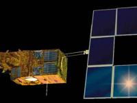
The satellites SPOT 4 (Satellite Probatoire de l'Observation de la Terre) was a second generation of SPOT earth observation satellite operated by Spot Image.

SPOT 4 used the improved bus design, which differed from the earlier SPOT series by having an increased lifetime of five years instead of three, a new extended platform design and service module, which can accommodate twice the payload. The propulsion module consists of a frame made of aluminum bars and two capillary tanks holding 158 kg of hydrazine.

The prime imaging instrument was HRVIR (High-Resolution Visible and Infrared sensor), which consisted of two pushbroom imaging units, an improved version of HRV. The two spectral modes are panchromatic and multispectral. The panchromatic band had a resolution of 10 meters, and the three multispectral bands (G,R,NIR) have resolutions of 20 meters.

An additional sensor for SPOT-4, called Vegetation or VMI (Vegetation Monitoring Instrument), with a ground swath width of 2200 km, and a resolution close to 1 km, providing the capability of wide-area monitoring of the Earth's vegetation. The instruments features advanced optics that allow perfect geometrical rectification of the pictures despite the wide swath width, as optics virtually cancel the curvature of the Earth to provide directly usable geographical information.

SPOT 4 was orbited on 24 March 1998 on an Ariane-40 H10-3 rocket. The mission ended on 29 June 2013.

Instruments:
2 HRVIRs (High-Resolution Visible and Infrared Sensor)
VEGETATION 1
DORIS (Doppler Orbitography and Radiopositioning Integrated by Satellite)
SILEX (Semiconductor Intersatellite Link Experiment)
PASTEC (PASsager TEChnologique de SPOT 4)
POAM-III (Polar Ozone and Aerosol Measurement)

24 Mar 1998
5years
Sun synchronous
101 minutes
High-Resolution Visible and Infrared (2x)
HRVIR (2x)
VEGETATION
Spot Image
ASTRIUM
Earth observation
Sécheresse
Éclatement du lac glaciaire
Glissement de terrain
Tremblement de terre
Inondation
Feu de forêt
Mouvement de masse
Pollution
Tsunami
Éruption volcanique
No
Information about SPOT 4

Footer menu

  • Contact
  • Terms of Use

User account menu

  • Log in