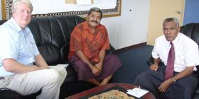
Two experts from UN-SPIDER
The mission included visits to government, regional and international organizations and key stakeholders.
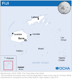
Fiji has established an effective administrative structure for disaster management spanning districts and divisions and the National Disaster Management Office (NDMO) is aware of the benefits of geo-spatial information, including space-based information. However, the NDMO does not yet have the capacity to elaborate maps and use such space-based information.
The Fiji Land Information System (FLIS) of the Land Department has a baseline geospatial database that covers the entire country and has developed data standards and data-sharing policies to make information widely available and usable to the stakeholders.
The NDMO has contacts with the South Pacific Applied Geoscience Commission (SOPAC) and with the Pacific Disaster Center (PDC), both of which provide geospatial information services in case of disasters.
The Pacific Disaster Center (PDC) has developed the Natural Hazards and Vulnerabilities Atlas as a free and openly-accessible internet map viewer that provides access to information about past, present and potential disasters. The Atlas contains information on major hazards, both "active" and "historical," including tropical cyclones, earthquakes, tsunamis, volcanoes, floods, and wildfires. It provides decision makers with the needed geospatial context for assessing risks and communicating about natural hazards and the exposure that people and infrastructure have to these hazards.
In January 2009, SOPAC purchased TERRASAR-X imagery from the German Aerospace Centre (DLR) to assist NDMO in the demarcation of inundated areas. In addition, SOPAC analysed satellite images acquired by the International Charter: Space and Major Disasters to help emergency response efforts as a consequence of the floods.
NDMO should promote the use of space based information when conducting hazard, vulnerability and risk mapping efforts. NDMO needs to have well documented plans in place for accessing satellite images required in all stages of disaster management. Additionally, it should have at least one expert with skills in information management, remote sensing and GIS to work on facilitating the access and analysis of spatial and disaster related data to serve the needs of end users. The expert would liaise with other agencies for data sharing, implement a Spatial Data Infrastructure (SDI), generate products and provide inputs for disaster risk management and response activities.
Fiji would benefit if awareness of space-based information was raised at the level of decision makers within NDMO and key ministries. The use of such information should be incorporated in policies and strategies focusing on disaster-risk reduction and emergency response activities.
NDMO should coordinate the development and implementation of a geographically referenced information flow between the Disaster Management Councils at all levels and NDMO to facilitate the preparation of hazard maps and maps of the areas affected by disasters.
NDMOs need to work closely with regional organizations to collaborate on data sharing and benefit from data analysis, mapping services, sharing expertise etc, including with the Fiji Land Information System of the Department of Land and Survey (FLIS) and SOPAC.
The Government of Fiji should consider the design and implementation of the National Spatial Database Infrastructure incorporating issues such as metadata, data structure and data sharing needs.


