• English
  • Español
  • Français

United
Nations


Office for Outer Space Affairs
UN-SPIDER Knowledge Portal

  • Accueil
  • À propos
    • Qu'est-ce que l'ONU-SPIDER?
    • À propos d’UNOOSA
    • Publications
    • Offres d'emploi
    • Rencontrez l'équipe
    • Contact
  • Applications spatiales
    • Technologie satellitaire
    • Mécanismes d’urgence
    • Recovery Mechanisms
    • Réseau international d'alerte aux astéroïdes
    • Space Mission Planning Advisory Group
    • Initiative internationale sur la météorologie spatiale
    • Les technologies spatiales à l'ONU
    • Comptes-rendus d'utilisateurs
  • Liens & ressources
    • Application de données du mois
      • Disaster Recovery
    • Sources de données
    • SIG et logiciels de télédétection
    • Online Learning Resources
    • Institutions
  • Risques & catastrophes
    • Prévention des risques de catastrophe
    • Systèmes d'alerte précoce
    • Gestion des catastrophes et des interventions d'urgence
    • Aléas naturels
    • Cadre d'action de Sendai
    • L'ONU et la prévention des risques de catastrophe
    • L'ONU et les alertes précoces
    • L'ONU et la gestion des catastrophes
  • Appui technique
    • Missions Conseil
    • Appui d’urgence
    • Appui à distance
    • Pratiques recommandées
    • Activités de formation
    • Utilisations pratiques
  • Réseaux
    • Bureaux régionaux d’appui
    • GP-STAR
    • MHEWS
    • IWG-SEM
  • Projets
    • SPEAR
    • SEWS-D
    • EvIDENz
    • Flood GUIDE
  • Actualités
    • Actualités
    • Événements
    • Événements passés
  • Admin
    • SAM Items

Breadcrumb

  • Home
  • Tropical Storm Isaac: Esri Offers Tracking Map
  • Tropical Storm Isaac: Esri offers tracking map

Tropical Storm Isaac: Esri offers tracking map

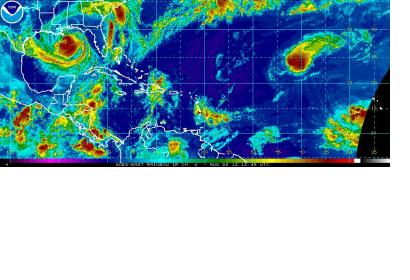
Satellite image of Tropical Storm Isaac.

Esri offers a free interactive map for tracking Isaac, a Tropical Storm rolling over the Gulf of Mexico on the verge of becoming a hurricane. The map was built using the ArcGIS API for JavaScript and is powered by ArcGIS Server. It offers constantly updated hurricane information on the projected paths, storm surge, weather warnings, and precipitation along with social media links that shows location-based feeds and community-derived content from Youtube, Twitter and Flickr.

The U.S. National Oceanic and Atmospheric Administration (NOAA) also release a dedicated webpage to Tropical Storm Isaac, providing the most recent forecast, tidal and waterlevel predictions and satellite imagery on Isaac. NOAA additionally provides regular and up-to-date information on Isaac via Twitter and Facebook.
ESRI News Maps
Tue, 28 Aug 2012 - 15:10

Footer menu

  • Contact
  • Terms of Use

User account menu

  • Log in