• English
  • Español
  • Français

United
Nations


Office for Outer Space Affairs
UN-SPIDER Knowledge Portal

  • Accueil
  • À propos
    • Qu'est-ce que l'ONU-SPIDER?
    • À propos d’UNOOSA
    • Publications
    • Offres d'emploi
    • Rencontrez l'équipe
    • Contact
  • Applications spatiales
    • Technologie satellitaire
    • Mécanismes d’urgence
    • Recovery Mechanisms
    • Réseau international d'alerte aux astéroïdes
    • Space Mission Planning Advisory Group
    • Initiative internationale sur la météorologie spatiale
    • Les technologies spatiales à l'ONU
    • Comptes-rendus d'utilisateurs
  • Liens & ressources
    • Application de données du mois
      • Disaster Recovery
    • Sources de données
    • SIG et logiciels de télédétection
    • Online Learning Resources
    • Institutions
  • Risques & catastrophes
    • Prévention des risques de catastrophe
    • Systèmes d'alerte précoce
    • Gestion des catastrophes et des interventions d'urgence
    • Aléas naturels
    • Cadre d'action de Sendai
    • L'ONU et la prévention des risques de catastrophe
    • L'ONU et les alertes précoces
    • L'ONU et la gestion des catastrophes
  • Appui technique
    • Missions Conseil
    • Appui d’urgence
    • Appui à distance
    • Pratiques recommandées
    • Activités de formation
    • Utilisations pratiques
  • Réseaux
    • Bureaux régionaux d’appui
    • GP-STAR
    • MHEWS
    • IWG-SEM
  • Projets
    • SPEAR
    • SEWS-D
    • EvIDENz
    • Flood GUIDE
  • Actualités
    • Actualités
    • Événements
    • Événements passés

Breadcrumb

  • Home
  • Uzbekistan: New Equipment To Forecast Disasters
  • Uzbekistan: New equipment to forecast disasters

Uzbekistan: New equipment to forecast disasters

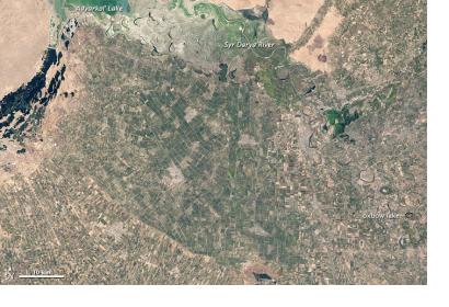
satellite image of UzbekistanKyzyl Kum Desert

The Japan International cooperation Agency (JICA) has provided the Institute of Geology and Geophysics in Uzbekistan with computer and GIS technology to monitor natural processes that may cause disasters such as earthquakes and landslides.

The GIS and remote sensing technology will enhance the observation activities of the Institute. Researchers have already been trained to work with the new technology. They will be able to recognize changes and developments and use them for forecasting and mitigation of disasters. The Institute will also receive software for satellite images processing. Nurtaev Bakhtiar, the Deputy Director of the Geology Institute added: “All this will allow us to analyse the systematic risks and improve methods for estimating seismic and landslide hazards.” 
Geospatial World
Fri, 7 Mar 2014 - 12:17
Uzbekistan

Footer menu

  • Contact
  • Terms of Use

User account menu

  • Log in