• English
  • Español
  • Français

United
Nations


Office for Outer Space Affairs
UN-SPIDER Knowledge Portal

  • Accueil
  • À propos
    • Qu'est-ce que l'ONU-SPIDER?
    • À propos d’UNOOSA
    • Publications
    • Offres d'emploi
    • Rencontrez l'équipe
    • Contact
  • Applications spatiales
    • Technologie satellitaire
    • Mécanismes d’urgence
    • Recovery Mechanisms
    • Réseau international d'alerte aux astéroïdes
    • Space Mission Planning Advisory Group
    • Initiative internationale sur la météorologie spatiale
    • Les technologies spatiales à l'ONU
    • Comptes-rendus d'utilisateurs
  • Liens & ressources
    • Application de données du mois
      • Disaster Recovery
    • Sources de données
    • SIG et logiciels de télédétection
    • Online Learning Resources
    • Institutions
  • Risques & catastrophes
    • Prévention des risques de catastrophe
    • Systèmes d'alerte précoce
    • Gestion des catastrophes et des interventions d'urgence
    • Aléas naturels
    • Cadre d'action de Sendai
    • L'ONU et la prévention des risques de catastrophe
    • L'ONU et les alertes précoces
    • L'ONU et la gestion des catastrophes
  • Appui technique
    • Missions Conseil
    • Appui d’urgence
    • Appui à distance
    • Pratiques recommandées
    • Activités de formation
    • Utilisations pratiques
  • Réseaux
    • Bureaux régionaux d’appui
    • GP-STAR
    • MHEWS
    • IWG-SEM
  • Projets
    • SPEAR
    • SEWS-D
    • EvIDENz
    • Flood GUIDE
  • Actualités
    • Actualités
    • Événements
    • Événements passés

Breadcrumb

  • Home
  • FAO Launches Global Land Cover SHARE Database
  • FAO launches Global Land Cover SHARE database

FAO launches Global Land Cover SHARE database

Satellite picture crop seedsAgricultural practices

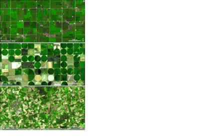
The Food and Agriculture Organization of the United Nations (FAO) recently released their Global Land Cover SHARE database (GLC-SHARE). It combines previously unharmonized data on global land cover and land use. The information covers different types of land cover – croplands, forests, soils – which have been gathered by different countries and organizations.

The database standardizes the information from numerous sources, using internationally accepted definitions and this way produced datasets for the whole planet. The new information set could be used for land use forecast and climate change impact monitoring.

"A strong understanding of our planet's land cover is essential to promoting sustainable land resources management - including agricultural production to feed a growing population - that makes efficient use of increasingly scarce natural resources yet safeguards the environment," said John Latham, of FAO's Land and Water Division. 
FAO
Fri, 21 Mar 2014 - 12:04

Footer menu

  • Contact
  • Terms of Use

User account menu

  • Log in