![]()
United
Nations
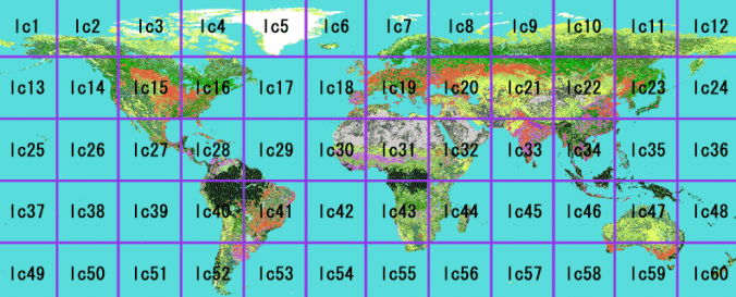
Global Map-Global Land Cover (GLCNMO - ISCGM)
| Data provided by: | International Steering Committee for Global Mapping (ISCGM) |
| Data accessibility: | export data, export map |
| Link to the data: | |
| Data type: | land use, land cover data |
| Disaster cycle phase: | Disaster Risk Management |
| Spatial coverage: | Global |
| Spatial resolution: | 500m-1000m |
| Temporal coverage: | Archive, Near-real time |
| Content dates: | 2003, 2008 |
| Technical Specifications: | |
| Costs: | free |
| Contact: | Contact ISCGM at sec@iscgm.org |
| Tutorials on the use of data: | Band Interleaved by Line (BIL) Format Description Properties |
| Restrictions/ Citation of the dataset: |
Provider
![]()