![]()
United
Nations
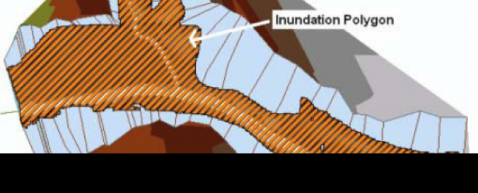
Cedar Creek DEM and Land Use (USGS)
| Data provided by: | United States Geological Survey (USGS) |
| Data accessibility: | export data |
| Link to the data: | |
| Data type: | elevation, land use, land cover data |
| Hazard: | Flood |
| Disaster cycle phase: | Disaster Risk Management |
| Spatial coverage: | United States of America |
| Temporal coverage: | Archive |
| Costs: | free |
| Contact: | Contact USGS |
| Tutorials on the use of data: | Recommended Practice: Flood Hazard Mapping (Purdue University), How to Download USGS Elevation, Land cover and Hydrography Data (Purdue Univers… |
| Restrictions/ Citation of the dataset: |
Provider
![]()