The team of seven experts, under leadership of the UN-SPIDER, visited Mongolia from 11-15 August 2014. The mission team represented following organisations: UN-SPIDER/UNOOSA, National Disaster Reduction Center of China (NDRCC), University of Georgia, Airbus Defence and Space, Asia Disaster Preparedness Center (ADPC), United Nations Office for the Coordination of Humanitarian Affairs (UNOCHA) and Asia-Pacific Space Cooperation Organization (APSCO). Some of these organisations are already engaged with organisations in Mongolia in the area of disaster management and space technology.
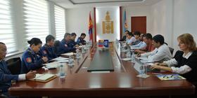
During this five-day mission, the mission team visited seven Ministries and Government agencies and three United Nations offices to carry out in-depth discussions. On 15 August, the Workshop “Use of Space Technology in Disaster Risk Management” was organized. About 40 officials representing various ministries/departments, institutions, and academia attended the workshop. The workshop generated awareness among a larger group of stakeholders in Mongolia, and sought their inputs on current challenges in using space-based information in disaster management.
- Mongolia has invested heavily in Earthquake Early Warning Systems and needs to strengthen its’ efforts towards disaster risk reduction as well as to be equipped with adequate capacity, skills and infrastructures;
- Local government agencies are heavily involved in emergency response activities;
- The laws, policies and plans related to disaster management are well thought out and entrusts the apex agency for emergency response and disaster risk reduction;
- Government is focusing on disaster risk reduction to reduce losses due to disasters;
- Many organizations are implementing several projects with national and international partners using Remote Sensing (RS) and Geographic Information System (GIS) technologies;
- There are a few good examples of agencies using RS/GIS but they are based mainly on coarse resolution satellite images.
Policy and Coordination
- Geo-spatial data policy should be formulation and implementation, as well as the NSDI initiative at the provisions in existing law and policy;
- Space-technology usage for disaster protection activities should be considered in the State Policy on Disaster Protection;
- Geospatial agencies should focus on using spatial data and remote sensing for disaster risk reduction and response;
- An effective data sharing policy should be formulized before the satellite launched
Data access, availability and sharing
- Data requirements and coordination should be clearly addressed in the procedure of emergency response;
- Promote the data sharing platform and mechanism at national level and local level;
- Take advantage of International/regional mechanism for data access among key agencies in Mongolia
Capacity Building and Institutional Strengthening
- Building capacity to use remote sensing data and data products among stakeholder organizations in Mongolia;
- Data providing agencies may require an upgrading of their skills and staff needs additional training on server based technologies;
- Sentinel Asia facilities needs a team of remote sensing/GIS Experts;
- Assessing the availability and accessibility of international space-based information is recommended.
Strengthening DRR Decision making
- DRR decision making calls for balanced effort to address issues with respect to stages of disaster management and related activities should be further linked to climate change issues involving space based information ;
- Long term analysis should be conducted on a regular basis;
- More detailed hazard assessments maps are needed for operational purposes;
- Mechanisms should be established for allowing for rapid data sharing with minimal administrative action;
Strengthening early warning and preparedness
- Risk prone areas should be identified for better preparedness and remote sensing should be incorporated into early warning and preparedness activities;
- Existing ground based infrastructure for early warning should be complemented with extended remote sensing programmes;
- GIS based information systems need to link to remote sensing data portals at provincial offices;
- Satellite based drought early warning information should be seen as a priority.
Strengthening emergency response
- Increased capacity is needed for managing other international mechanisms;
- Key stakeholder agencies should discuss ways to get the right information products suitable for large scale disaster response;
- Spatial information products should be accurately expressed that expected to receive from other institutions and enhance GIS facilities with high resolution images and large scale;
- Technical agencies should consider seconding their staff to coordination organization during an emergency.