  • English
  • Español
  • Français

United
Nations


Office for Outer Space Affairs
UN-SPIDER Knowledge Portal

  • Accueil
  • À propos
    • Qu'est-ce que l'ONU-SPIDER?
    • À propos d’UNOOSA
    • Publications
    • Offres d'emploi
    • Rencontrez l'équipe
    • Contact
  • Applications spatiales
    • Technologie satellitaire
    • Mécanismes d’urgence
    • Recovery Mechanisms
    • Réseau international d'alerte aux astéroïdes
    • Space Mission Planning Advisory Group
    • Initiative internationale sur la météorologie spatiale
    • Les technologies spatiales à l'ONU
    • Comptes-rendus d'utilisateurs
  • Liens & ressources
    • Application de données du mois
      • Disaster Recovery
    • Sources de données
    • SIG et logiciels de télédétection
    • Online Learning Resources
    • Institutions
  • Risques & catastrophes
    • Prévention des risques de catastrophe
    • Systèmes d'alerte précoce
    • Gestion des catastrophes et des interventions d'urgence
    • Aléas naturels
    • Cadre d'action de Sendai
    • L'ONU et la prévention des risques de catastrophe
    • L'ONU et les alertes précoces
    • L'ONU et la gestion des catastrophes
  • Appui technique
    • Missions Conseil
    • Appui d’urgence
    • Appui à distance
    • Pratiques recommandées
    • Activités de formation
    • Utilisations pratiques
  • Réseaux
    • Bureaux régionaux d’appui
    • GP-STAR
    • MHEWS
    • IWG-SEM
  • Projets
    • SPEAR
    • SEWS-D
    • EvIDENz
    • Flood GUIDE
  • Actualités
    • Actualités
    • Événements
    • Événements passés
  • Admin
    • SAM Items

Breadcrumb

  • Home
  • Geosat-1 (Deimos-1)
  • Geosat-1 (Deimos-1)

Geosat-1 (Deimos-1)

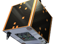
The Deimos-1 mission is fully owned and operated by Deimos Imaging (DMI), an UrtheCast company. Deimos-1 satellite was successfully launched on 29 July 2009 from the Baikonur Launch Complex (Kazakhstan) in the Russian-Ukrainian Dnepr launcher. The mission is fully dedicated to Earth Observation and captures images all around the world. Thus, currently the Deimos-1 system provides capabilities well above and beyond the design goals.
The payload is a three-band multispectral imager system with 22m Ground Sample Distance (GSD) at nominal altitude (663 km) with 625 km swath, 8 or 10 bits radiometric depth available. Imager delivers data in three spectral bands, very close to the Near-Infrared (NIR), Red (R) and Green (G) bands in the Landsat series of US satellites. The satellite payload is a dual bank linear CCD push broom imager, so that banks are mounted at an angle to provide a wide imaging swath, one of the most characteristics Deimos-1 features.

Renamed to Geosat-1 in 2021.

Instrument: SLIM-6 optical imager
- swath width: 625km
- 3 spectral bands (NIR, R, G)
- push broom

29 Jul 2009
5years
Sun synchronous
Multispectral Imaging Spectrometer
DEIMOS Imaging
GEOSAT
Assuring very-high-frequency revisit on large areas with precision agriculture and forestry monitoring applications in mind
Sécheresse
Éclatement du lac glaciaire
Feu de forêt
Tsunami
Tremblement de terre
Éruption volcanique
Mouvement de masse
Glissement de terrain
Inondation
No
Geosat Homepage

Footer menu

  • Contact
  • Terms of Use

User account menu

  • Log in