The team of 11 experts, under the leadership of the United Nations Office for Outer Space Affairs (UNOOSA)/UN-SPIDER), visited NEPAL from 31 July to 4 August 2017. The mission team represented the following organizations: UNOOSA/UN-SPIDER, ICIMOD, Chinese Academy of Sciences, United Nations Office for the Coordination of Humanitarian Affairs (UNOCHA), United Nations Development Programme (UNDP), Center for Interdisciplinary Geospatial Technology of Delta State University, United Nations Affiliated Centre for Space Science and Technology Education for Asia and the Pacific hosted by Indian Space Research Organisation and DigitalGlobe, Singapore.
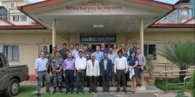
During the five-day mission, the mission team visited key stakeholder agencies to carry out in-depth discussions on the current and potential use of space based information in all aspects of disaster management and offering recommendations to strengthen the disaster risk management and emergency response in the country. A one-day workshop was conducted as a part of this mission, which was attended by more than 65 participants. On the fifth day, the mission team compiled and presented their observations and recommendations to high-level officials of the MoHA, United Nations Resident Coordinator’s Office (UN-RCO) and other key stakeholders.
Policy
- Many agencies visited have incorporated GIS and remote sensing in their activities. However it seems rather ad hoc and not guided by an overall policy for using space based technology for DRR and DM.
- Data provision from different agencies is fragmented and lacks clear policy and responsibilities for data generation, maintenance and update.
- Critical is the missing NSDI and related activities. Access to data due to inadequate policy framing has been highlighted several times as a crucial issue to advance DRR related activities.
- National Strategy for Disaster Risk Management NSDRM 2009 Priority Action 2 (Identify, assess and monitor disaster risks and strengthen early warning System) relates to “Establish and institutionalize authentic, and open GIS-based Disaster Information Management System (DIMS) at all levels).
- Natural Calamity (Relief) Act, 1982 is under revision which provides opportunities to integrate the use of space based information in line with the Sendai Framework.
Data availability and sharing
- ICIMOD is well placed to access earth observation data through SERVIR, Sentinel Asia and other programmes. Some agencies have UAVs.
- There is no national agency responsible for driving remote sensing based progammes.
- Baseline GIS data is available, although it is not clear how data is shared, used and its quality. This restricts interoperability among the GIS layers developed by various organizations.
- This data gap is filled with open street map data and other separate initiatives.
- A lot of valuable geospatial data is available and more are being collected, however, there is a lack of data standards, metadata and data accessibility mainly due to lack of policy guidelines, appropriate software and hardware issues.
- Departments are unable or not forthcoming to share data. Data is not posted publicly and is usually shared on an ad-hoc and informal basis due to lack of policy guidelines.
- There are no targeted missions to generate hazard, vulnerability and risk maps. Such gap is filled by many non government actors. Use of EO based input is minimal.
Capacity Building and Institutional Strengthening
- CSSTEAP has over 100 alumni in Nepal trained in RS/GIS, SatCom, SatMetetc. Several others are trained in the other institutions.
- Trained staff cannot make use of their capacities due to limitations in policy framing (except Nepalese Army and APF).
- Capacity building should be guided by a strategy that addresses long-term capacity building needs;
- Additionally danger exists that staff cannot upgrade and refresh their capacities as they are losing the connection to state-of-the-art knowledge.
- Government institutions involved in geospatial technologies have not adequately planned for the required software, hardware, and skills maintenance needed to keep systems running.
- Again the situation is better outside the governmental intuitions -especially with very high level capacities at ICIMOD, as well as different NGOs.
Policy
- Integrate space based and geospatial information while the following policy documents are revised: DM Act, National Strategy for Disaster Risk Management (NSDRM), 2009 and National Disaster Response Framework (NDRF), 2013
- Create a national data policy that includes data standards (including geospatial data), which points to a clear need for National Spatial Data Infrastructure (NSDI);
- Develop guidelines for a disaster inventory database and clearly spell out, who will provide services, who will use them, and for what purpose.
- To ensure the efficient use of resources in support of DRR, there should be a department or entity that is entirely dedicated to coordination. ;
- In the meantime, there can still be coordination between agencies producing and using data for disaster management and emergency response. MoHA can convene an information management or GIS working group. This group will coordinate data management activities, share data, develop standards, and work toward there being no duplication of efforts.
- Army, APF, NGOs (KLL, Nepal GIS Society), Survey Department and ICIMOD are important players.
Data availability and sharing
- “One Nation-One Map” policy to promote the preparation of base line thematic layers including hazard and risk maps at highest possible resolution and scale by respective agencies in a time bound manner.
- Policy document and related actions to convince key ministries to invest in earth observation and geospatial information, which leads to faster economic growth.
- Data access should be explicitly addressed in high level policy or strategy. Then technology can easily be put in place to facilitate data access.
- Organisations like DWIDM, DHM, DMG needs clear mandate and strategic guidance from MoHA to undertake hazard/risk mapping.
- A portal for discovering national data assets is needed, regardless of whether or not data may be shared freely, for cost, or not at all. This will reduce duplication of effort.
- Overarching plan to generate spatial data is needed (land use, soil, hydro-geomorphology, water resources, socio-economic etc.)
Capacity Building and Institutional Strengthening
- Capacity building should be guided by a strategy that addresses long-term capacity building needs;
- Use of in-house institutions to offer regular capacity building programmes focused on space technology applications in specific themes and upcoming innovations;
- Develop technological capacity or set up a dedicated centre that would provide technical support to NEOC; and
- Ensure trained staffs remain in their positions within the government department allowing them to focus on specific technical skills to leverage remote sensing and GIS in support of DRR and DM.
- Capacity existing in other institutions such as ICIMOD can be used as a valuable resource to maintain capacity within the government.
- Explore opportunities for Public-Private Partnership
Strengthening Disaster Risk Reduction
- Critical role by NEOC in facilitating hazard, vulnerability and risk maps using Earth observation;
- National mission guiding the use of geospatial technology in disaster management include inventory, monitoring, spatial analysis and modeling and developing GIS-based tools for hazard, vulnerability and risk analysis.
- Establishment of a technical centre within NEOC which can be partly manned by staff from stakeholder ministries. This centre should be able to coordinate and use information generated by all stakeholder agencies during all stages of disaster management; and
- For disaster risk reduction, preparation of hazard zonation maps, early warning and mainstreaming guide lines are considered as key areas to focus.
- DRR should be a key component of sustainable development (SDG) and integrate climate change adaptation.
Strengthening early warning and preparedness
- The existing early warning system (EWS) should be strengthened by building expertise on advanced applications of Earth observation (reference ICIMOD efforts);
- There is an urgent need to build capacities for multi-hazard use of EWS, where information (thematic maps, risk maps etc.) generated from satellite images can be integrated with early warning information; and
- Strengthen capacities in providing more accurate and localized early warning information that can be used for local disaster preparedness and response at the community level.
Strengthening emergency response
- Develop routine mechanism to use Earth observation to provide situational awareness to support NEOC and ensure coordinated and effective response during emergencies;
- NEOC should become an Authorised User of the International Charter for Space and utilized Sentinel Asia facility at ICIMOD;
- Prepare SOPs for acquisition and utilisation of space based information during emergency response (Reference: WG in UN-SPIDER Conference 2015)
- The training and mock drills on routine basis to enable stakeholders to make good use of international support
- Information sharing channels during emergencies should be clarified in the legal and strategic documents developed by MoHA
- Cross train geospatial professionals with DM –the two are largely treated as independent functions.
- Basic map reading and land navigation skills must be taught across all entities involved with DM, particular within the response community
- Prepare and implement a geospatial strategy and NSDI under leadership of MoHA, in close collaboration with main players;
- Develop an institutional capacity development strategy;
- Prepare and implement a plan to address Priority 1 of Sendai framework by developing methods identify risks, hazards and vulnerabilities using geoinformation; and
- Prepare and implement a plan to address Priority 4 of Sendai framework for Disaster Reduction: 2015-2030 by developing SOP to use earth observation for enhancing disaster preparedness for effective response.
Actions identified during debriefing at Ministry of Home Affairs on the 5th day of the TAM
- Re-start planning to develop an NSDI. Under the leadership of the Survey Dept, but with the active participation of all concerned agencies and partners. (governmental and Non-governmental agencies)
- Strengthen DRR portal to host relevant data related to DRR
- TAM to suggest innovative approaches in capacity building for mainstreaming Space tech in DRR and DR
- Enhance existing partnerships to maximize the use of space tech at EOC.
- Suggest mechanisms for using space technology to identify and address vulnerability. (focus on more accessible technology –not high-tech)
- TAM to recommend ways to strengthen DRR, perhaps through strengthened partnership with academic partnerships.
- TAM to share our observations on capacity of the different agencies of the GoN.
- UN to explore ways to support the GoNin efforts to improve the use of space technology for DRR.
- Support awareness raising activities at the very senior government level on the benefits of GIS and remote sensing in DRR (and beyond). TAM can share lessons learned
- TAM to suggest ways to better manage and use information in support of emergency response operations. (i.e review DRR Portal)
- Establish an executive and technical committee under the leadership of NEOC. (or the to-be-established NDMC)
- Executive committee to look at policy and mandate issues
- Technical committee to coordinate data collection activities, identify data sources, and establish data standards and guidance.