  • English
  • Español
  • Français

United
Nations


Office for Outer Space Affairs
UN-SPIDER Knowledge Portal

  • Accueil
  • À propos
    • Qu'est-ce que l'ONU-SPIDER?
    • À propos d’UNOOSA
    • Publications
    • Offres d'emploi
    • Rencontrez l'équipe
    • Contact
  • Applications spatiales
    • Technologie satellitaire
    • Mécanismes d’urgence
    • Recovery Mechanisms
    • Réseau international d'alerte aux astéroïdes
    • Space Mission Planning Advisory Group
    • Initiative internationale sur la météorologie spatiale
    • Les technologies spatiales à l'ONU
    • Comptes-rendus d'utilisateurs
  • Liens & ressources
    • Application de données du mois
      • Disaster Recovery
    • Sources de données
    • SIG et logiciels de télédétection
    • Online Learning Resources
    • Institutions
  • Risques & catastrophes
    • Prévention des risques de catastrophe
    • Systèmes d'alerte précoce
    • Gestion des catastrophes et des interventions d'urgence
    • Aléas naturels
    • Cadre d'action de Sendai
    • L'ONU et la prévention des risques de catastrophe
    • L'ONU et les alertes précoces
    • L'ONU et la gestion des catastrophes
  • Appui technique
    • Missions Conseil
    • Appui d’urgence
    • Appui à distance
    • Pratiques recommandées
    • Activités de formation
    • Utilisations pratiques
  • Réseaux
    • Bureaux régionaux d’appui
    • GP-STAR
    • MHEWS
    • IWG-SEM
  • Projets
    • SPEAR
    • SEWS-D
    • EvIDENz
    • Flood GUIDE
    • CommonSpace Initiative
    • Tonga Pilot Project
  • Actualités
    • Actualités
    • Événements
    • Événements passés

Breadcrumb

  • Home
  • KOMPSAT-3A / Arirang-3A
  • KOMPSAT-3A / Arirang-3A

KOMPSAT-3A / Arirang-3A

KOMPSAT-3A is the world’s first civilian satellite that is equipped with a high-resolution, infrared(MWIR) sensor which enables nighttime observation. It also provides the optical images with high resolution of 50 cm or less for the second in the world following the US.
The technology of improving the optical image quality by 30% or more without degradation using diagonal data to provide 38-cm-class images was developed for the second following the EU.
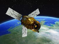
The high-resolution electro-optical spaceborne camera AEISS-A(Advanced Earth Imaging Sensor System-A) developed by KARI and accommodated on KOMPSAT-3A platform features 50cm class optical photography, which marks the highest resolution among cameras mounted on domestic satellites. The IR sensor, which is capable of detecting heat on the ground, is used to observe fire, volcanic activity and urban thermal islands during nighttime, even under any weather conditions.
KOMPSAT-3A operates in the sun’s synchronous orbit at an altitude of 528km and passes over Korea twice(day and night), photographing the Korean Peninsula for up to 50 minutes each day.
The spacecraft bus of KOMPSAT-3A was developed by a private enterprise, while KARI transferred the technology to expand the domestic satellite industrial base.

Instrument: AEISS-A (Advanced Earth Imaging Sensor System-A)
- 6 spectral bands (PAN, blue, green, red, NIR, MWIR)
- swath width: 12km (at nadir)

26 Mar 2015
4years
Sun synchronous
99 minutes
KARI
Cartography, land use and planning, disaster monitoring
Sécheresse
Éclatement du lac glaciaire
Glissement de terrain
Tremblement de terre
Inondation
Feu de forêt
Mouvement de masse
Tsunami
Éruption volcanique
Yes
Information about KOMPSAT-3A on KARI web page

Footer menu

  • Contact
  • Terms of Use

User account menu

  • Log in