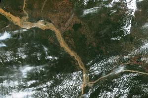
Heavy rains since the onset of the rainy season in July have caused extensive floods in Nigeria, especially along the Niger river. The floods have led to destruction of shelters, which has driven displacement inside the country.
Upon the request of the National Emergency Management Agency (NEMA), UN-SPIDER and its Regional Support Office in Nigeria, the National Space Research and Development Agency (NASRDA), have produced maps outlining the extent of the floods in different areas along the Niger river between Sarafu in the North and Yenegoa in the Niger Delta. The maps were produced using the UN-SPIDER Recommended Practices on flood mapping with Sentinel-1 radar imagery in Google Earth Engine as well as in SNAP and QGIS.
Source | Title | URL |
|---|---|---|
UN-SPIDER | Map: Floods - Kebbi state, Nigeria (29/08/2020). | |
UN-SPIDER | Map: Floods along the Niger river in Niger state (10/09/2020). | |
UN-SPIDER | Map: Floods along the Niger river in Niger state, Nigeria. Focus on the area around Pategi (10/09/2020). | |
UN-SPIDER | Map: Floods along the Niver river in Niger state, Nigeria. Focus on the area around Lafiagi (10/09/2020). | |
UN-SPIDER | Map: Floods along the Niver river in Niger state, Nigeria. Focus on the area around Katcha (10/09/2020). | |
UN-SPIDER | Map: Floods along the Niger river from Sarafu in the North to Yenegoa in the South (22/09/2020). | |
UN-SPIDER | Floods along the Niger river from Sarafu in the North to Yenegoa in the South - Focus on the area between Sarafu and Jebba (22/09/2020). | |
UN-SPIDER | Floods along the Niger river from Sarafu in the North to Yenegoa in the South - Focus on the area between Jebba and Pategi (22/09/2020). | |
UN-SPIDER | Floods along the Niger river from Sarafu in the North to Yenegoa in the South - Focus on the area between Pategi and Idah (22/09/2020). | |
UN-SPIDER | Floods along the Niger river from Sarafu in the North to Yenegoa in the South - Focus on the area between Idah and Yenegoa (22/09/2020). |
