Skip to main content
English
Español
Français
United
Nations
Office for Outer Space Affairs
UN-SPIDER Knowledge Portal
Rechercher
Accueil
À propos
Qu'est-ce que l'ONU-SPIDER?
À propos d’UNOOSA
Publications
Offres d'emploi
Rencontrez l'équipe
Contact
Applications spatiales
Technologie satellitaire
Mécanismes d’urgence
Recovery Mechanisms
Réseau international d'alerte aux astéroïdes
Space Mission Planning Advisory Group
Initiative internationale sur la météorologie spatiale
Les technologies spatiales à l'ONU
Comptes-rendus d'utilisateurs
Liens & ressources
Application de données du mois
Disaster Recovery
Sources de données
SIG et logiciels de télédétection
Online Learning Resources
Institutions
Risques & catastrophes
Prévention des risques de catastrophe
Systèmes d'alerte précoce
Gestion des catastrophes et des interventions d'urgence
Aléas naturels
Cadre d'action de Sendai
L'ONU et la prévention des risques de catastrophe
L'ONU et les alertes précoces
L'ONU et la gestion des catastrophes
Appui technique
Missions Conseil
Appui d’urgence
Appui à distance
Pratiques recommandées
Activités de formation
Utilisations pratiques
Réseaux
Bureaux régionaux d’appui
GP-STAR
MHEWS
IWG-SEM
Projets
SPEAR
SEWS-D
EvIDENz
Flood GUIDE
CommonSpace Initiative
Tonga Pilot Project
Actualités
Actualités
Événements
Événements passés
Breadcrumb
Home
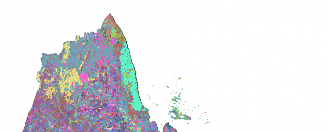
Land Cover, Eritrea (Africover, FAO)
Land Cover, Eritrea (Africover, FAO)
Land Cover, Eritrea (Africover, FAO)
Data provided by:
Food and Agriculture Organization of the United Nations (FAO)
Data accessibility:
export data
Link to the data:
Metadata and download: MULTIPURPOSE LANDCOVER DATABASE FOR ERITREA - AFRICOVER
Metadata and download: SPATIALLY AGGREGATED MULTIPURPOSE LANDCOVER DATABASE FO…
Metadata and download: BOUNDARIES OF ERITREA - AFRICOVER
Metadata and download: GEOMORPHOLOGY - LANDFORM AND LITHOLOGY FOR ERITREA - AF…
Metadata and download: THEMATIC WOODY AGGREGATION FOR ERITREA - AFRICOVER
Metadata and download: THEMATIC AGRICULTURE AGGREGATION FOR ERITREA - AFRICOVER
Metadata and download: LANDFORM FOR ERITREA - THEMATIC AGGREGATION GEOMORPHOLO…
Metadata and download: LITHOLOGY FOR ERITREA - THEMATIC AGGREGATION GEOMORPHOL…
Metadata and download: THEMATIC GRASSLAND AGGREGATION FOR ERITREA - AFRICOVER
File type:
shp
,
shp
,
shp
Data type:
land use, land cover data
Disaster cycle phase:
Disaster Risk Management
Satellites and Sensors:
Landsat 4
Spatial coverage:
Eritrea
Temporal coverage:
Archive
Technical Specifications:
About Africover
Costs:
free
Contact:
GIS-Manager@fao.org
Provider