  • English
  • Español
  • Français

United
Nations


Office for Outer Space Affairs
UN-SPIDER Knowledge Portal

  • Home
  • About Us
    • What is UN-SPIDER?
    • About UNOOSA
    • Publications
    • Jobs
    • Meet the Team
    • Contact
  • Space Application
    • Satellite Technology
    • Emergency Mechanisms
    • Recovery Mechanisms
    • International Asteroid Warning Network
    • Space Mission Planning Advisory Group
    • International Space Weather Initiative
    • Space Technologies in the UN
    • User Stories
  • Links & Resources
    • Data Applications
      • Disaster Recovery
    • Data Sources
    • GIS and Remote Sensing Software
    • Online Learning Resources
    • Institutions
  • Risks & Disasters
    • Disaster Risk Management
    • Early Warning Systems
    • Emergency and Disaster Management
    • Natural Hazards
    • Sendai Framework
    • The UN and Disaster Risk Management
    • The UN and Early Warning
    • The UN and Disaster Management
  • Advisory Support
    • Advisory Missions
    • Emergency Support
    • Virtual Advisory Support
    • Recommended Practices
    • Training Activities
    • Practical Uses
  • Network
    • Regional Support Offices
    • GP-STAR
    • MHEWS
    • IWG-SEM
  • Projects
    • SPEAR
    • SEWS-D
    • EvIDENz
    • Flood GUIDE
  • News & Events
    • News
    • Events Calendar
    • UN-SPIDER Events Archive

Breadcrumb

  • Home
  • Landsat 4
  • Landsat 4

Landsat 4

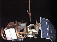
Landsat 4 was launched on July 16, 1982. The Landsat 4 spacecraft was significantly different than that of the previous Landsats, and Landsat 4 did not carry the RBV instrument.
In addition to the Multispectral Scanner System (MSS) instrument, Landsat 4 (and Landsat 5) carried a sensor with improved spectral and spatial resolution, i.e., the new satellites could see a wider (and more scientifically-tailored) portion of the electromagnetic spectrum and could see the ground in greater detail. This new instrument was known as the Thematic Mapper (TM).
Landsat 4 was kept in orbit for housekeeping telemetry command and tracking data (which it downlinked via a separate data path, the S-band) until it was decommissioned in 2001.
While Landsat 4 was built and launched by NASA, NOAA initially oversaw the operations of the satellite. Landsat 4 operations were contracted out to the Earth Observation Satellite Company (EOSAT) corporation in 1984.
By 1998, the management of the Landsat 4 (and Landsat 5) operations contract was transferred from NOAA to the USGS; operations were continued by the private sector until mid-2001 when Space Imaging (formerly EOSAT) returned the operations contract to the U.S. Government.
Despite the numerous transfers of satellite operation, the USGS has remained responsible for long-term preservation of Landsat data in its National Satellite Land Remote Sensing Data Archive (NSLRSDA) in Sioux Falls, South Dakota.

Instruments:
Multispectral Scanner (MSS)
Thematic Mapper (TM)

16 Jul 1982
1993-12-14
Polar
Sun synchronous
99 minutes
MSS
TM
NASA
USGS
NOAA
Earth observation; housekeeping telemetry command and tracking data
Drought
Tsunami
Earthquake
Flood
Forest Fire
Volcanic Eruption
Mass Movement
No
information about Landsat 4 on NASA web page

Footer menu

  • Contact
  • Terms of Use

User account menu

  • Log in