Skip to main content
English
Español
Français
United
Nations
Office for Outer Space Affairs
UN-SPIDER Knowledge Portal
Search
Home
About Us
What is UN-SPIDER?
About UNOOSA
Publications
Jobs
Meet the Team
Contact
Space Application
Satellite Technology
Emergency Mechanisms
Recovery Mechanisms
International Asteroid Warning Network
Space Mission Planning Advisory Group
International Space Weather Initiative
Space Technologies in the UN
User Stories
Links & Resources
Data Applications
Disaster Recovery
Data Sources
GIS and Remote Sensing Software
Online Learning Resources
Institutions
Risks & Disasters
Disaster Risk Management
Early Warning Systems
Emergency and Disaster Management
Natural Hazards
Sendai Framework
The UN and Disaster Risk Management
The UN and Early Warning
The UN and Disaster Management
Advisory Support
Advisory Missions
Emergency Support
Virtual Advisory Support
Recommended Practices
Training Activities
Practical Uses
Network
Regional Support Offices
GP-STAR
MHEWS
IWG-SEM
Projects
SPEAR
SEWS-D
EvIDENz
Flood GUIDE
CommonSpace Initiative
Tonga Pilot Project
News & Events
News
Events Calendar
UN-SPIDER Events Archive
Breadcrumb
Home
Satellite Data, Products and Other Resources
Data Sources
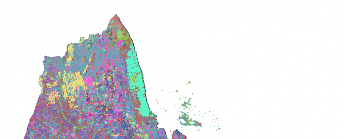
Land Cover, Eritrea (Africover, FAO)
Land Cover, Eritrea (Africover, FAO)
Land Cover, Eritrea (Africover, FAO)
Data provided by:
Food and Agriculture Organization of the United Nations (FAO)
Data accessibility:
export data
Link to the data:
Metadata and download: MULTIPURPOSE LANDCOVER DATABASE FOR ERITREA - AFRICOVER
Metadata and download: SPATIALLY AGGREGATED MULTIPURPOSE LANDCOVER DATABASE FO…
Metadata and download: BOUNDARIES OF ERITREA - AFRICOVER
Metadata and download: GEOMORPHOLOGY - LANDFORM AND LITHOLOGY FOR ERITREA - AF…
Metadata and download: THEMATIC WOODY AGGREGATION FOR ERITREA - AFRICOVER
Metadata and download: THEMATIC AGRICULTURE AGGREGATION FOR ERITREA - AFRICOVER
Metadata and download: LANDFORM FOR ERITREA - THEMATIC AGGREGATION GEOMORPHOLO…
Metadata and download: LITHOLOGY FOR ERITREA - THEMATIC AGGREGATION GEOMORPHOL…
Metadata and download: THEMATIC GRASSLAND AGGREGATION FOR ERITREA - AFRICOVER
File type:
shp
,
shp
,
shp
Data type:
land use, land cover data
Disaster cycle phase:
Disaster Risk Management
Satellites and Sensors:
Landsat 4
Spatial coverage:
Eritrea
Temporal coverage:
Archive
Technical Specifications:
About Africover
Costs:
free
Contact:
GIS-Manager@fao.org
Provider