![]()
United
Nations
Éruption volcanique
 on the Landsat 8 satellite acquired this top image of Mount Etna on December 28, 2018. The image highlights the active vent and thermal infrared signature from lava flows, which can be seen near the newly formed fissure on the southeastern side of the volcano. The image was created with data from OLI (bands 4-3-2) and the Thermal Infrared Sensor (TIRS) on Landsat 8. Image: NASA.")
Definition
Facts and figures
Further information
UN-SPIDER Regional Support Offices with hazard-specific expertise
Related content on the Knowledge Portal

On 22 December 2018 a large chunk of the Anak Krakatau volcanic island collapsed into the ocean, causing a tsunami that swept across Indonesia’s Sunda Strait. Because tsunami early warning systems are exclusively equipped to detect tsunamis that are generated by earthquakes, this volcanic collapse-caused tsunami took place without a warning. In the coastal regions of Java and Sumatra, where people were struck off guard, the tsunami killed 400 people and injured many more.
A recent research study published in Nature Communications and led by the German Research Centre for Geosciences (GFZ) has detected deformations in Anak Krakatau leading up to the tsunami that could serve as an early warning system for future volcanic collapses. Satellite data plays a key role in developing such early warning systems by providing monitoring capabilities. As early as late June 2018, the Moderate Resolution Imaging…
read more13/11/2019
“More than half of the world’s active volcanoes are not monitored instrumentally,” according to GFZ Helmholtz Centre Potsdam. Yet eruptions occur quite frequently, with up to 85 of the 1500 active volcanoes erupting each year, and can cause significant damage. For example, the 2018 volcanic eruptions at Fuego (Guatemala) and Anak Krakatau (Indonesia) resulted in 430 dead and missing persons. This threat to human life makes improving the monitoring of volcanoes all the more important.
A German research team, made up of scientists from the Technical University of Berlin and the GFZ German Research Centre for Geosciences in…
read more06/08/2019
In the past year, “there were 315 natural disaster events recorded with 11,804 deaths, over 68 million people affected, and US$131.7 billion in economic losses around the world.” This is according to the Centre for Research on the Epidemiology of Disasters (CRED) in its recently released 2018 Natural Disasters Report.
While these 2018 natural disaster values represent a decrease when compared with the annual averages from 2008 to 2017, some geographic areas still experienced great losses of life and damages due to natural hazards. Indonesia was most adversely impacted in terms of lives claimed, with earthquakes in August and September 2018 that left a total of 4,904 people dead or missing, according to the CRED. Earthquakes also accounted for the greatest number of deaths among natural disasters worldwide in 2018. And among all types of natural hazards, floods affected the greatest number of people during the…
read more01/07/2019- New satellite-based study of Latin America volcanoes could help researchers better predict eruptions

To predict when a volcano will erupt, researchers rely on indirect signals. However, without long-term and ground-based observations, it is difficult to determine whether these signals are normal disturbances or indicators of a looming eruption. New research suggests satellite data could help to fill that gap and improve scientists understanding of the complex warning signs a volcano may issue before it erupts.
The multidecadal study analyzed 17 years of remote sensing observations of 47 volcanoes in Latin America, where more than 60 per cent of active volcanoes are unmonitored. The researchers looked at three types of data: sulfur dioxide gas emissions, which often increase before a volcano erupts; thermal measurements and radar data that show how a volcano is changing shape.
On the basis of their analysis of the satellite data, the team found that the majority of the 47 volcanoes were on a spectrum between open systems, able to release…
read more04/04/2019 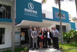 ,
,  ,
, 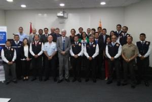
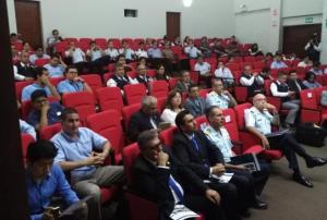
As part of it advisory support activities, UN-SPIDER is carrying out out a Technical Advisory Mission (TAM) to Peru from 1 to 5 April to evaluate the current and potential use of space-based information in all aspects of disaster management. Based on exchanges with a wide range of stakeholders, UN-SPIDER will provide recommendations as to how to strengthen the use of space-based information in disaster risk management and emergency response in the country.
The team of experts led by UN-SPIDER is conducting multiple activities and institutional visits in Lima. The team is comprised of eight experts from UN-SPIDER; the German Aerospace Centre (DLR); the Argentinian National Space Activities Commission (CONAE); the Mexican Space Agency (AEM); the Agustin Codazzi Geographic Institute of Colombia (IGAC); the Santa Maria…
read more01/04/2019
A team of scientists, led by the University of Bristol’s School of Earth Sciences, has used Sentinel-1 satellite imagery to analyze the ground deformation of the Agung volcano in Bali, Indonesia, and explain why it erupted in November 2017 after 50 years of dormancy.
The previous eruption of Agung in 1963 killed nearly 2,000 people and was followed by a small eruption of its neighbouring volcano, Batur. Because this past event was among the deadliest volcanic eruptions of the 20th century, the scientific community deployed a great effort into the monitoring and understanding of the re-awakening of Agung.
Two months before the eruption, a sudden increase in the number of small earthquakes occurred around the volcano. The researchers realized satellite images could reveal the volcanic ground deformation that occurred prior to the 2017 eruption. From satellite imagery and 3D numerical models…
read more06/03/2019
Satellites from NASA and the US National Oceanic and Atmospheric Administration (NOAA) are monitoring the eruption of Volcan de Fuego (Volcano of Fire) in Guatemala that has killed at least 69 people since it started erupting on 3 June 2018.
The Visible Infrared Imaging Radiometer Suite (VIIRS) onboard the joint NOAA/NASA Suomi National Polar-orbiting Partnership (Suomi-NPP) satellite captured an imagery) of the eruption and resulting ash plume emitted by the volcano.
Such satellite images can be utilised by civil authorities, scientists and the local population to understand where pyroclastic flows, a high-density mix of hot lava blocks, pumice, ash and volcanic gas, are moving in order to avoid disaster.
Just before noon on 3 June, the Volcan de Fuego, which is located approximately 50 kilometres southwest of Guatemala City, produced an explosive eruption that sent ash billowing thousands of metres into the air. A deadly…
read more06/06/2018
The International Charter “Space and Major Disasters” has been activated for Guatemala’s Fuego volcano on 5 June.
Guatemala’s most powerful eruption in 100 years has killed at least 69 people with many more missing, according to local reports.
A state of emergency has been declared with the eruption, which started on Sunday, cascaded vast clouds of volcanic ash, rocks and toxic gas into the atmosphere. 3,000 local residents have been evacuated into temporary shelters as pyroclastic flows threaten to engulf villages surrounding the volcano.
Fuego is situated 40km south-west of the capital Guatemala City and the eruption closed the city’s La Aurora International Airport as the clouds of volcanic ash and gases rose 10 km into the air.
Emergency responders are working alongside soldiers and firefighters to search for missing people in the dense covering of ash, mud and volcanic rock…
read more05/06/2018 volcano in Kamchatka, Russian Federation emitting an ash plume taken by NASA’s Aqua satellite in 2012. Image: NASA Earth Observatory.") Significant activity from volcanoes in the Russian Federation have been observed from space in recent months. The Kamchatka and Kuril Islands volcanoes, located in the fact east of the country, are being monitored by satellites in order to avert the hazards caused by their regular eruptions to air travel and to local populations. These volcanoes are among the most active in the world, generally erupting between three and seven times every year. As of 4 May 2018, two volcanoes in Kamchatka - Karymysky and Sheveluch - are [subject](http://www.kscnet.ru/ivs/kvert/index_eng.php) to an orange [aviation colour code](http://www.wovo.org/aviation-colour-codes.html) meaning that a volcano is exhibiting heightened unrest with increased likelihood of eruption or that a volcanic eruption is underway with no or minor ash emission. The Ebeko volcano located in the Kuril Islands is also subject to the same warning. When volcanoes in the region erupt, they tend to produce large ash clouds that… read more16/05/2018
Significant activity from volcanoes in the Russian Federation have been observed from space in recent months. The Kamchatka and Kuril Islands volcanoes, located in the fact east of the country, are being monitored by satellites in order to avert the hazards caused by their regular eruptions to air travel and to local populations. These volcanoes are among the most active in the world, generally erupting between three and seven times every year. As of 4 May 2018, two volcanoes in Kamchatka - Karymysky and Sheveluch - are [subject](http://www.kscnet.ru/ivs/kvert/index_eng.php) to an orange [aviation colour code](http://www.wovo.org/aviation-colour-codes.html) meaning that a volcano is exhibiting heightened unrest with increased likelihood of eruption or that a volcanic eruption is underway with no or minor ash emission. The Ebeko volcano located in the Kuril Islands is also subject to the same warning. When volcanoes in the region erupt, they tend to produce large ash clouds that… read more16/05/2018 NASA satellites are closely monitoring Kilauea volcano in Hawaii, United States of America amid fears that the ongoing eruption could cause further evacuation of the local population.On 30 April 2018, the floor of Kilauea’s crater began to collapse. Earthquakes followed, including one that measured magnitude 6.9, and lava was pushed into new underground areas that eventually broke through the ground in areas such as Leilani Estates. The fissures and high levels of sulphur dioxide gas prompted the authorities to order nearly 2,000 residents to evacuate Lanipuna Gardens and the neighbouring…read more13/05/2018
UN-SPIDER Regional Support Offices with hazard-specific expertise
![]()