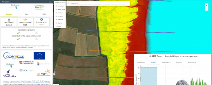
MI-SAFE (FAST)

| Data provided by: | Foreshore Assessment using Space Technology (FAST) |
| Data accessibility: | export data, export map, statistical data (e.g. graphs), visualization of data (e.g. web GIS or real time monitoring) |
| Link to the data: | |
| Data type: | baseline data, elevation, hazard specific data, satellite data or aerial image |
| Hazard: | Flood |
| Disaster cycle phase: | Disaster Risk Management |
| Space-based Information: | DEM, LiDAR, Satellite data |
| Satellites and Sensors: | Sentinel-1A, Sentinel-2A, Landsat 1, Landsat 7, Landsat 8 |
| Spatial coverage: | Global |
| Spatial resolution: | 0.02 - 6000 m |
| Temporal coverage: | Archive |
| Technical Specifications: | |
| Costs: | free |
| Contact: | FAST project team |
| Tutorials on the use of data: | FAST project on-line flood hazard tool: How to use MI-SAFE v0.1, MI-SAFE: Accessing products and services using the web viewer |
| Restrictions/ Citation of the dataset: | Use of the MI-SAFE Viewer 1.User shall only be authorised to use the MI-SAFE Viewer within its own organisation, for its own use and for the following purposes: a.Research for non-engineering and non-operational purposes; and b. Research and evaluation of the functionalities of the MI-SAFE Viewer itself. 2. Within the boundaries of a., User may use the MI-SAFE Viewer to obtain first indications of the potential impact of vegetated foreshores on flood risk reduction for any shoreline in the world, which indications User may use to support the inclusion of ecosystem-engineering concepts in coastal protection quick assessments. 3.User shall not be permitted to make any other use of the MI-SAFE Viewer or to make available or grant access to the MI-SAFE Viewer to any third party. 4.User shall not be permitted to use the MI-SAFE Viewer for engineering and operational purposes, such as for detailed design and detailed planning. Article 4: Intellectual Property Rights, Ownership, input data With the Agreement, Deltares only grants User the rights to MI-SAFE Viewer as described in Articles 2 and 3. User acknowledges and agrees that with this Agreement no transfer of ownership whatsoever, including the transfer of the intellectual property rights, is made to User. 2. Deltares and the other parties of the FAST team have made the MI-SAFE Viewer to use open data of the highest quality available, being free data from several third-party resources and subject to their respective license terms and conditions. User acknowledges and agrees that the use and functioning of the MI-SAFE Viewer also depend on the acceptance by User of these data-user terms and conditions and that User shall not hold Deltares, or the FAST team, responsible for the quality or availability of data or for the related terms and conditions. No guarantee, no warranty The MI-SAFE Viewer is developed by Deltares and the FAST team and has not been thoroughly tested, verified or validated or whatsoever. User acknowledges and agrees that the MI-SAFE Viewer may contain defects and errors and may not be expected to function always and/or fully nor that results obtained with the MI-SAFE Viewer are correct or of proper quality always. These results depend on the quality of input data as well. See for input data and their quality the Science behind MI-SAFE. The user also acknowledges that Deltares is under no obligation to correct any defects or errors in the MI-SAFE Viewer or to otherwise support or maintain MI-SAFE Viewer. See further: http://fast.openearth.eu/doc/I_Agree_MI-SAFE_viewer(non-commercial_SLA)v1.3.pdf |
