Skip to main content
English
Español
Français
United
Nations
Office for Outer Space Affairs
UN-SPIDER Knowledge Portal
Rechercher
Accueil
À propos
Qu'est-ce que l'ONU-SPIDER?
À propos d’UNOOSA
Publications
Offres d'emploi
Rencontrez l'équipe
Contact
Applications spatiales
Technologie satellitaire
Mécanismes d’urgence
Recovery Mechanisms
Réseau international d'alerte aux astéroïdes
Space Mission Planning Advisory Group
Initiative internationale sur la météorologie spatiale
Les technologies spatiales à l'ONU
Comptes-rendus d'utilisateurs
Liens & ressources
Application de données du mois
Disaster Recovery
Sources de données
SIG et logiciels de télédétection
Online Learning Resources
Institutions
Risques & catastrophes
Prévention des risques de catastrophe
Systèmes d'alerte précoce
Gestion des catastrophes et des interventions d'urgence
Aléas naturels
Cadre d'action de Sendai
L'ONU et la prévention des risques de catastrophe
L'ONU et les alertes précoces
L'ONU et la gestion des catastrophes
Appui technique
Missions Conseil
Appui d’urgence
Appui à distance
Pratiques recommandées
Activités de formation
Utilisations pratiques
Réseaux
Bureaux régionaux d’appui
GP-STAR
MHEWS
IWG-SEM
Projets
SPEAR
SEWS-D
EvIDENz
Flood GUIDE
CommonSpace Initiative
Tonga Pilot Project
Actualités
Actualités
Événements
Événements passés
Breadcrumb
Home
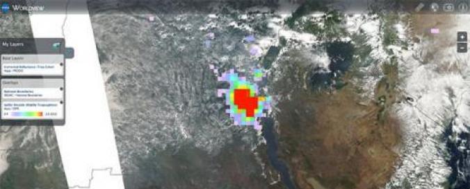
Near Real-Time Data Related To Ash Plumes (LANCE - NASA)
Near Real-Time data related to Ash Plumes (LANCE - NASA)
Near Real-Time data related to Ash Plumes (LANCE - NASA)
Data provided by:
National Aeronautics and Space Administration (NASA)
Data accessibility:
export data, export map, visualization of data (e.g. web GIS or real time monitoring)
Link to the data:
Free Registration (required to dowload data)
MYD04_L2 L2 Aerosol, 5-Min Swath 10km
MYD09GA L2G Light Surface Reflectance – Daily 500m and 1km
MYD09GQ L2G Light Surface Reflectance – Daily 250m
MYD09GHK L2G Surface Reflectance – Daily 500m
MYD09GQK L2G Surface Reflectance – Daily 250m
MOD04_L2 L2 Aerosol, 5-Min Swath 10km
MOD09GA L2G Light Surface Reflectance – Daily 500m and 1km
MOD09GQ L2G Light Surface Reflectance – Daily 250m
MOD09GQK L2G Surface Reflectance – Daily 250m
AIRVBRAD_NRT L1B Vis/Near-IR geolocated radiances
AIRABRAD_NRT L1B AMSU-A1 & AMSU-A2 combined, geolocated & calibrated brightness…
ML2SO2_NRT.003 Sulfur Dioxide (SO2) MLS/Aura NRT L2 SO2 Mixing Ratio
File type:
hdf
,
hdf
,
hdf
,
hdf
Data type:
hazard specific data
Hazard:
Forest Fire
,
Volcanic Eruption
,
Pollution
Disaster cycle phase:
Disaster Risk Management, Response, Recovery
Space-based Information:
MODIS / Aqua, MODIS / Terra, AIRS / Aqua, MLS / Aura
Spatial coverage:
Global
Spatial resolution:
500.00
Temporal coverage:
Archive, Near-real time
Content dates:
MODIS/Aqua Start Date: 2002-07-04; MODIS/Terra Start Date: 2000-02-24; AIRS / Aqua: Start Date: 2014-03-11 Stop Date: 2014-03-18; MLS/Aura Start Date: 2014-03-11 Stop Date: 2014-03-18.
Technical Specifications:
Read "Summary" section (MYD04_L2 L2 Aerosol, 5-Min Swath 10km)
Read "Summary" section (MYD09GA L2G Light Surface Reflectance – Daily 500m and …
Read "Summary" section (MYD09GQ L2G Light Surface Reflectance – Daily 250m)
Read "Summary" section (MYD09GHK L2G Surface Reflectance – Daily 500m)
Read "Summary" section (MYD09GQK L2G Surface Reflectance – Daily 250m)
Read "Summary" section (MOD04_L2 L2 Aerosol, 5-Min Swath 10km)
Read "Summary" section (MOD09GA L2G Light Surface Reflectance – Daily 500m and …
Read "Summary" section (MOD09GQ L2G Light Surface Reflectance – Daily 250m)
Read "Summary" section (MOD09GQK L2G Surface Reflectance – Daily 250m)
Read "Summary" section (AIRVBRAD_NRT L1B Vis/Near-IR geolocated radiances)
Read "Summary" section (AIRABRAD_NRT L1B AMSU-A1 & AMSU-A2 combined, geolocated…
Read "Summary" section (ML2SO2_NRT.003 Sulfur Dioxide (SO2) MLS/Aura NRT L2 SO2…
Costs:
free
Contact:
Contacts
Tutorials on the use of data:
Coprehensive examples about how to access and visualize NASA .hdf files
Restrictions/ Citation of the dataset:
Disclaimer
NASA Web Privacy Policy and Important Notices
Provider