
Having access to precise geographical data and the ability to analyze them easily is essential for effective disaster and risk management. EUMETSAT delivers meteorological, climate and ocean data as well as analytical tools to all registered users worldwide. Recently they released three new data pilot services, which are highly valuable throughout the full disaster management cycle: EUMETSAT DATA Store, EUMETSAT Data Tailor and EUMETView. The services are part of a suite of products developed to simplify the work with big data as well as with the already existing other EUMETSAT products.
All of the new services can be accessed through EUMETSAT’s Earth Observation Portal. They not only improve how users view the data but also how they interact with them. The next generation of EUMETView and the new DATA Store complement EUMETCast, which gives access to near-real time data, and the EUMETSAT Data centre, which provides historical data. Thus users get access to near real-time data through web user interfaces (Web UI) and Application Programming Interfaces (APIs). The purpose of the new Data Tailor is to tailor data products from EUMETSAT into standard geospatial formats that can be used with any geospatial information system. This makes it easier and quicker for all users to combine and compare data.
EUMETView is an Online Map Service (OMS), which encapsulates a web map service, a web coverage service and a web feature service. Its new pilot version contains new features for creating maps as well as displaying visualisations across the EUMETSAT product range. Users can interact with these services through a customizable WebUI and an enhanced set of Open Geospatial Consortium (OGC) standard APIs. The API allows users to integrate EUMETView into other applications and systematically download images and products without accessing the web user interface. In addition, EUMETView gives the possibility to personalise data viewing, add layers by satellite or theme and to save these settings for future use. Personalization enables the user to change the area of interest, map projection, base maps and overlays. Furthermore, through the time navigation interface it helps to navigate several products concurrently in time. Training material on EUMETView and its features is available on the EUMETSAT website in the form of Jupyter Notebooks and on the YouTube Channel.
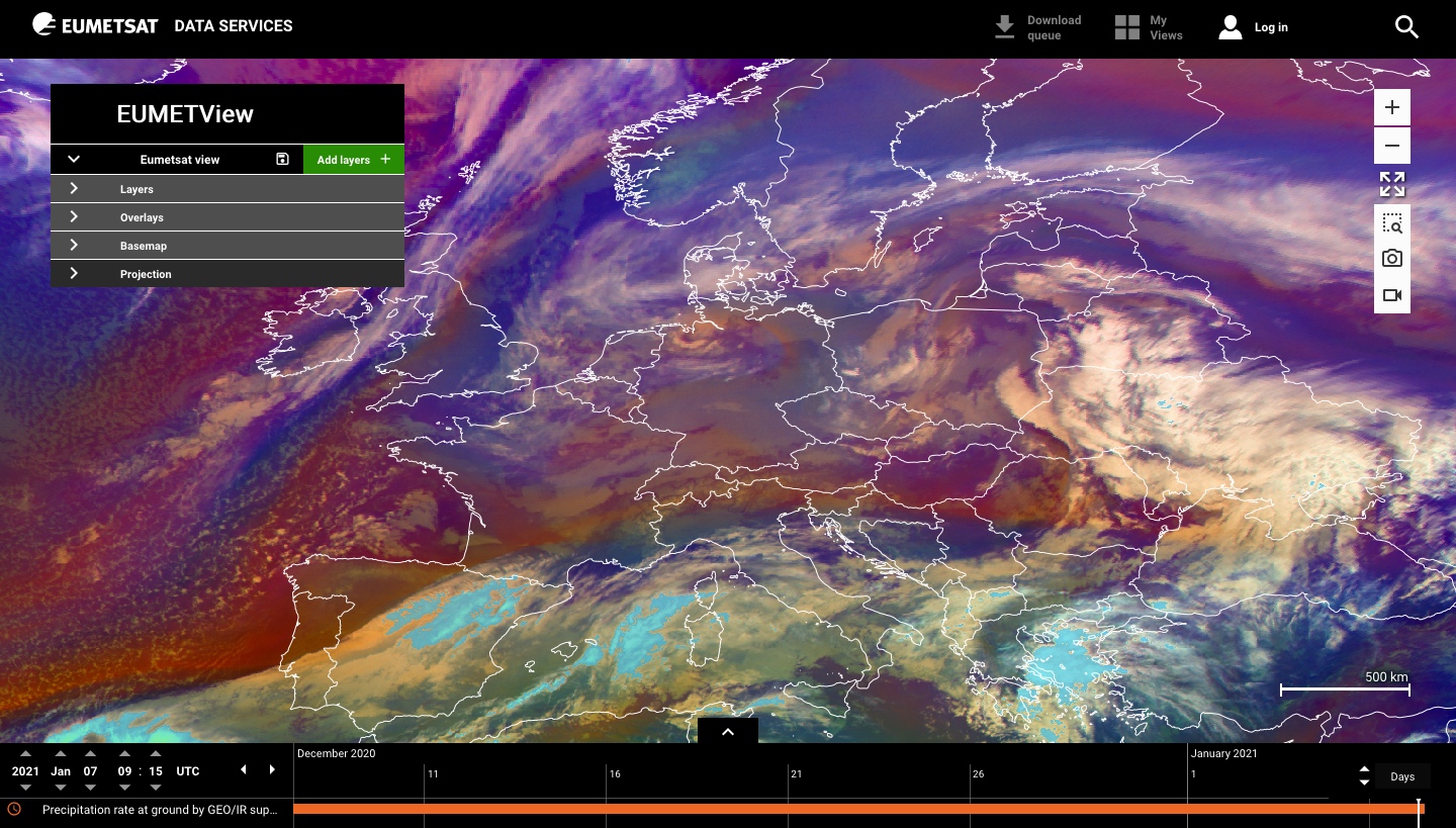
Screenshot of EUMETView interface. Image: EUMETSAT
As EUMETSAT produces a lot of products in a variety of formats, some of them in binary bespoke formats, in the past it was required that users implement software that was specifically adapted to the EUMETSAT data products in order to read them. Data Tailor will eliminate this problem by helping to convert EUMETSAT data products into a format that can be readily consumed by a geographic information system. This allows the user to easily work with different data products and to analyze their data. Data Tailor makes it possible for users to subset and aggregate the EUMETSAT data products in space and time, filter layers, generate quick looks, project onto new coordinate reference systems, and reformat into common GIS formats. It also offers a uniform way to transform both historical and near real-time satellite data provided by EUMETSAT. A comprehensive step by step guide for the use of the Data Tailor is available on the EUMETSAT Data Tailor knowledge base.
The new pilot EUMETSAT Data Store allows users to have access to a growing catalogue of meteorological, climate and ocean data through a single point of access. Eventually, more and more data will be added so that the full data catalogue, including near-real time and historic data and climate data records will be available on the Data Store. It can be accessed through an online web interface, and through a suite of APIs. Products identified in the store can be combined with the functionality provided by the Data Tailor API, allowing for product customisation by the downloading of data, the ability to search products based on collections and to filter based on date, region of interest, timeliness, and coverage. More information as well as training material, in the form of Jupyter Notebooks, can be found at the Data Store knowledge base documentation.